Port Huron, Michigan Map and Directory
Regional Directory > States Menu > Michigan
 According to the United States Census Bureau, Port Huron is a City that is located in St. Clair County, Michigan at 42.97 degrees North and 82.42 degrees West.
The city's time zone is America/Detroit, and the city's primary telephone area code is 810.
The land area of Port Huron is about 8.09 square miles, whereas the water area of the city is about 4.18 square miles.
According to the United States Census Bureau, Port Huron is a City that is located in St. Clair County, Michigan at 42.97 degrees North and 82.42 degrees West.
The city's time zone is America/Detroit, and the city's primary telephone area code is 810.
The land area of Port Huron is about 8.09 square miles, whereas the water area of the city is about 4.18 square miles.
The Census Bureau estimates that Port Huron had about 28,749 residents in 2019, which is approximately 3,554 people per square mile of land area.
According to recent American Community Survey data, the median household income in Port Huron was about $38,808 per year.
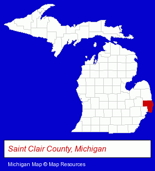
The Michigan counties map at upper right shows St. Clair County, highlighted in red. Use the menu below to display interactive maps of Port Huron, either in a frame on this page or in full-screen mode.
Use the menu below to display categorized Port Huron directories.
| Port Huron Products and Services Directory | ||
|---|---|---|
| Home Improvement | Insurance | Physicians |
Selected Port Huron, Michigan Listings
These representative Port Huron listings in 48060 provide a window into the city's cultural environment and economic climate. Afx Industries LLC- Auto Parts Wholesale & Manufacturers
- Sporting Goods Dealers
- Fishing Equipment & Supplies Dealers
- Fishing Bait & Tackle
- Ice Hockey Equipment & Supplies
- Marinas
- Docks
- Boat & Boat Trailer Storage
- Optometrists
- Optical Goods Retail
- Metals
- Metal Products
- Metal Products Wholesale & Manufacturers
- Metal Products Dealers
- Restaurants
- Steak Restaurants
- Coffee & Tea Shops
- Take Out
- Cafes
- Alternative Medicine
- Chiropractors
- Nurseries
- Flower Wholesalers
Nearby Michigan Cities and Towns *
- Mount Clemens (5) - Mount Clemens, Michigan demographics and maps.
* Parenthesized numbers indicate economic activity levels.
Copyright © 2011-2026 RegionalDirectory.us. All rights reserved.