Portage, Michigan Map and Directory
Regional Directory > States Menu > Michigan
 According to the United States Census Bureau, Portage is a City that is located in Kalamazoo County, Michigan at 42.20 degrees North and 85.58 degrees West.
The city's time zone is America/Detroit, and the city's primary telephone area code is 269.
The land area of Portage is about 32.22 square miles, whereas the water area of the city is about 2.94 square miles.
Kalamazoo County's land area is about 562 square miles, so the city occupies about 5.7 percent of the county's total land area.
According to the United States Census Bureau, Portage is a City that is located in Kalamazoo County, Michigan at 42.20 degrees North and 85.58 degrees West.
The city's time zone is America/Detroit, and the city's primary telephone area code is 269.
The land area of Portage is about 32.22 square miles, whereas the water area of the city is about 2.94 square miles.
Kalamazoo County's land area is about 562 square miles, so the city occupies about 5.7 percent of the county's total land area.
The Census Bureau estimates that Portage had about 49,445 residents in 2019, which is approximately 1,535 people per square mile of land area.
According to recent American Community Survey data, the median household income in Portage was about $62,941 per year.
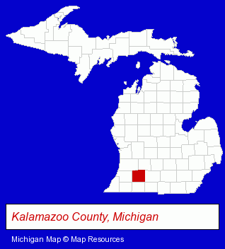
The Michigan counties map at upper right shows Kalamazoo County, highlighted in red. Use the menu below to display interactive maps of Portage, either in a frame on this page or in full-screen mode.
Use the menu below to display categorized Portage directories.
| Portage Products and Services Directory | ||
|---|---|---|
| Auto Service | Building Materials | Business Services |
| Dentists | Home Furnishings | Home Improvement |
| Metals | Printing and Publishing | Schools |
Selected Portage, Michigan Listings
These randomly selected Portage listings provide some insight into the city's cultural environment and economic climate.- Janitorial Equipment & Supplies Retail
- Medical Equipment & Supplies Retail
- Wheelchair Lifts & Scooters
- Home Health Care Equipment & Supplies
- Home Improvement Stores
- Hardware Dealers
- Fasteners
- Auto Body Repair & Painting
- Auto Customizing, Conversion & Restoration
- Custom Auto Painting
- Industrial Equipment & Supplies Dealers
- Steak Restaurants
- Coffee & Tea Shops
- Cafes
- Lawn & Garden Services
- Landscape Equipment & Supplies Dealers
- Industrial Equipment & Supplies Wholesale & Manufacturers
- Machine Tools Wholesale & Manufacturing
- Telecommunications Consultants
- Telecommunications Management Services
- Medical Equipment & Supplies Retail
- Diapers & Diaper Services
- Osteopathic Physicians & Surgeons
- Pediatrics Physicians & Surgeons
- Interior Decorators & Designers
- Commercial & Graphic Artists
- Corporate Business Attorneys
- Personal Injury Attorneys
- Family Law Attorneys
- Employment & Labor Law Attorneys
Nearby Michigan Cities and Towns *
- Battle Creek (7) - Battle Creek, Michigan demographics and maps.
- Dowagiac (1) - Dowagiac, Michigan information and maps.
- Hastings (3) - Hastings, Michigan information and maps.
- Kalamazoo (27) - Kalamazoo, Michigan solutions directory and maps.
- Middleville (1) - Middleville, Michigan information and maps.
- Three Rivers (1) - Three Rivers, Michigan information and maps.
- Vicksburg (1) - Vicksburg, Michigan information and maps.
* Parenthesized numbers indicate economic activity levels.
Copyright © 2011-2026 RegionalDirectory.us. All rights reserved.