Roseville, Michigan Map and Directory
Regional Directory > States Menu > Michigan
 According to the United States Census Bureau, Roseville is a City that is located in Macomb County, Michigan at 42.50 degrees North and 82.94 degrees West.
The city's time zone is America/Detroit, and the city's primary telephone area code is 586.
The land area of Roseville is about 9.83 square miles, whereas the water area of the city is about 0.03 square miles.
Macomb County's land area is about 479 square miles, so the city occupies about 2.1 percent of the county's total land area.
According to the United States Census Bureau, Roseville is a City that is located in Macomb County, Michigan at 42.50 degrees North and 82.94 degrees West.
The city's time zone is America/Detroit, and the city's primary telephone area code is 586.
The land area of Roseville is about 9.83 square miles, whereas the water area of the city is about 0.03 square miles.
Macomb County's land area is about 479 square miles, so the city occupies about 2.1 percent of the county's total land area.
The Census Bureau estimates that Roseville had about 47,018 residents in 2019, which is approximately 4,783 people per square mile of land area.
According to recent American Community Survey data, the median household income in Roseville was about $47,648 per year.
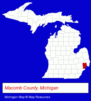
The Michigan counties map at upper right shows Macomb County, highlighted in red. Use the menu below to display interactive maps of Roseville, either in a frame on this page or in full-screen mode.
Use the menu below to display categorized Roseville directories.
| Roseville Products and Services Directory | ||
|---|---|---|
| Auto Service | Building Materials | Home Improvement |
| Metals | ||
Selected Roseville, Michigan Listings
These randomly selected Roseville listings provide some insight into the city's cultural environment and economic climate.- Home Improvement Stores
- Hardware Dealers
- Fasteners
- Paint Stores
- Auto Paint
- Auto Body Equipment & Supplies Retail
- Painting Equipment & Supplies Rental
- Pizza Restaurants
- Pediatrics Physicians & Surgeons
- Welding Services
- Welding Contractors
- Truck Dealers
- Used Cars
- Used Trucks
- Cutting Tools Wholesale & Manufacturers
- Osteopathic Physicians & Surgeons
- Neurology Physicians & Surgeons
- Industrial Equipment & Supplies Dealers
- Industrial Equipment Rebuilding, Service & Repair
- Auto Parts Wholesale & Manufacturers
- Business Services
- Business Consultants & Advisors
- Advertising
- Advertising Agencies & Consultants
- Auto Parts Wholesale & Manufacturers
- Tires Wholesale & Manufacturers
- Auto Tire Shop Equipment & Supplies
Nearby Michigan Cities and Towns *
- Grosse Pointe (3) - Grosse Pointe, Michigan information and maps.
- Madison Heights (7) - Madison Heights, Michigan demographics and maps.
- Mount Clemens (5) - Mount Clemens, Michigan demographics and maps.
- Saint Clair Shores (5) - Saint Clair Shores, Michigan demographics and maps.
- Sterling Heights (10) - Sterling Heights, Michigan demographics and directory.
* Parenthesized numbers indicate economic activity levels.
Copyright © 2011-2026 RegionalDirectory.us. All rights reserved.