Mankato, Minnesota Map and Directory
Regional Directory > States Menu > Minnesota
 According to the United States Census Bureau, Mankato is a City that is located primarily in Blue Earth County, Minnesota at 44.17 degrees North and 93.98 degrees West.
The city's time zone is America/Chicago, and the city's primary telephone area code is 507.
The land area of Mankato is about 18.48 square miles, whereas the water area of the city is about 0.34 square miles.
According to the United States Census Bureau, Mankato is a City that is located primarily in Blue Earth County, Minnesota at 44.17 degrees North and 93.98 degrees West.
The city's time zone is America/Chicago, and the city's primary telephone area code is 507.
The land area of Mankato is about 18.48 square miles, whereas the water area of the city is about 0.34 square miles.
The Census Bureau estimates that Mankato had about 42,931 residents in 2019, which is approximately 2,323 people per square mile of land area.
According to recent American Community Survey data, the median household income in Mankato was about $47,924 per year.
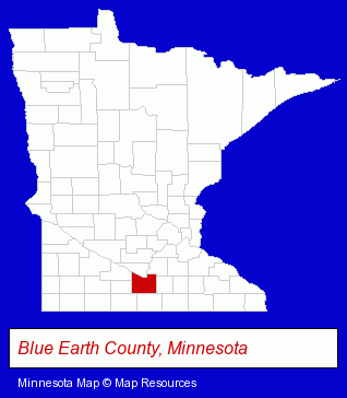
The Minnesota counties map at upper right shows Blue Earth County, highlighted in red. Use the menu below to display interactive maps of Mankato, either in a frame on this page or in full-screen mode.
Use the menu below to display categorized Mankato directories.
| Mankato Products and Services Directory | ||
|---|---|---|
| Accountants | Attorneys | Auto Service |
| Building Materials | Clinics | Financial Services |
| Home Improvement | Metals | Restaurants |
| Schools | Steak Restaurants | Visual Arts |
Selected Mankato, Minnesota Listings
These randomly selected Mankato listings in 56001 provide a window into the city's cultural environment and economic climate. Affordable Towing- Towing
- Metal Finishing
- Building & Home Construction
- Builders & Contractors
- Excavation Contractors
- Foundation Contractors
- Insurance
- Photography
- Photographic Equipment & Supplies Retail
- Funeral Services
- Funeral Homes & Directors
- Cremation Services
- Funeral Services
- Funeral Homes & Directors
- Cemeteries & Memorial Parks
- Cemeteries & Crematories
- Cremation Services
- Legal Services
- Court Reporting
- Court & Convention Reporters
- Veterinarians
- Animal Hospitals
- Animal Health
- Computer & Equipment Dealers
- Computer Networks
- Caterers
- Engineers
- Mechanical Engineers
Nearby Minnesota Cities and Towns *
- Blue Earth (1) - Blue Earth, Minnesota information and maps.
- New Ulm (1) - New Ulm, Minnesota information and maps.
* Parenthesized numbers indicate economic activity levels.
Copyright © 2011-2026 RegionalDirectory.us. All rights reserved.