Minneapolis, Minnesota Map and Directory
Regional Directory > States Menu > Minnesota
 According to the United States Census Bureau, Minneapolis is a City that is located in Hennepin County, Minnesota at 44.98 degrees North and 93.26 degrees West.
The city's time zone is America/Chicago, and the city's primary telephone area code is 612.
The land area of Minneapolis is about 54.01 square miles, whereas the water area of the city is about 3.48 square miles.
Hennepin County's land area is about 554 square miles, so the city occupies about 9.7 percent of the county's total land area.
According to the United States Census Bureau, Minneapolis is a City that is located in Hennepin County, Minnesota at 44.98 degrees North and 93.26 degrees West.
The city's time zone is America/Chicago, and the city's primary telephone area code is 612.
The land area of Minneapolis is about 54.01 square miles, whereas the water area of the city is about 3.48 square miles.
Hennepin County's land area is about 554 square miles, so the city occupies about 9.7 percent of the county's total land area.
The Census Bureau estimates that Minneapolis had about 429,606 residents in 2019, which is approximately 7,954 people per square mile of land area.
According to recent American Community Survey data, the median household income in Minneapolis was about $62,583 per year. This Minneapolis Real Estate directory lists real estate solution providers in Minneapolis, Minnesota.
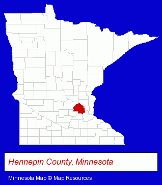
The Minnesota counties map at upper right shows Hennepin County, highlighted in red. Use the menu below to display interactive maps of Minneapolis, either in a frame on this page or in full-screen mode.
Use the menu below to display categorized Minneapolis directories.
Selected Minneapolis, Minnesota Listings
These randomly selected Minneapolis listings provide some insight into the city's cultural environment and economic climate.- Floors & Flooring Retail
- Wood & Laminate Flooring
- Adhesives & Glues
- Adhesive & Glues Wholesale & Manufacturers
- Photography
- Professional Photographers
- Photographers Commercial & Industrial
- Business Consultants & Advisors
- Management Consultants
- Business Management Services
- Real Estate Commercial & Industrial
- Real Estate Developers & Subdividers
- Real Estate Investments
- Building & Home Construction
- Metals
- Metal Products
- Metal Products Wholesale & Manufacturers
- General Merchandise Wholesale
- Alternative Medicine
- Chiropractors
- Alternative Medicine Practitioners
- Business Consultants & Advisors
- Management Consultants
- Business Management Services
- Environmental Organizations
- Energy Conservation Engineers
- Energy Conservation Products & Services
- Corporate Business Attorneys
- Real Estate Attorneys
- Employment & Labor Law Attorneys
- General Practice
- Gynecology & Obstetrics Physicians & Surgeons
- Art Galleries & Dealers
Nearby Minnesota Cities and Towns *
- Anoka (7) - Anoka, Minnesota demographics and maps.
- Burnsville (14) - Burnsville, Minnesota demographics and directory.
- Eden Prairie (11) - Eden Prairie, Minnesota demographics and directory.
- Hopkins (10) - Hopkins, Minnesota demographics and directory.
- Minnetonka (4) - Minnetonka, Minnesota information and maps.
- Osseo (13) - Osseo, Minnesota demographics and directory.
- Saint Paul (85) - Saint Paul, Minnesota products & services directory.
Large and Mid-size Cities in Nearby States
- Hudson, Wisconsin (10) - Hudson, WI demographics and maps.
* Parenthesized numbers indicate economic activity levels.
Copyright © 2011-2026 RegionalDirectory.us. All rights reserved.