Chesterfield, Missouri Map and Directory
Regional Directory > States Menu > Missouri
 According to the United States Census Bureau, Chesterfield is a City that is located in St. Louis County, Missouri at 38.66 degrees North and 90.58 degrees West.
The city's time zone is America/Chicago, and the city's primary telephone area code is 636.
The land area of Chesterfield is about 31.81 square miles, whereas the water area of the city is about 1.74 square miles.
According to the United States Census Bureau, Chesterfield is a City that is located in St. Louis County, Missouri at 38.66 degrees North and 90.58 degrees West.
The city's time zone is America/Chicago, and the city's primary telephone area code is 636.
The land area of Chesterfield is about 31.81 square miles, whereas the water area of the city is about 1.74 square miles.
The Census Bureau estimates that Chesterfield had about 47,538 residents in 2019, which is approximately 1,494 people per square mile of land area.
According to recent American Community Survey data, the median household income in Chesterfield was about $113,315 per year. This Chesterfield Real Estate directory lists real estate solution providers in Chesterfield, Missouri.
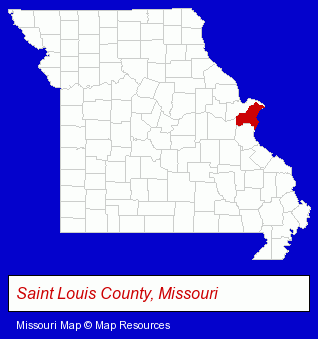
The Missouri counties map at upper right shows St. Louis County, highlighted in red. Use the menu below to display interactive maps of Chesterfield, either in a frame on this page or in full-screen mode.
Use the menu below to display categorized Chesterfield directories.
| Chesterfield Products and Services Directory | ||
|---|---|---|
| Accountants | Attorneys | Building Contractors |
| Building Materials | Clinics | Dentists |
| Financial Counselors | Financial Services | Health Clubs and Gyms |
| Home Improvement | Information Technology | Insurance |
| Optometrists | Physicians | Restaurants |
Selected Chesterfield, Missouri Listings
These randomly selected Chesterfield listings in 63005 provide a window into the city's cultural environment and economic climate. A Fresh Web Design St Louis- Web Site Design
- Web Sites
- Web Site Developers
- Computer Graphics & Imaging
- Computer Animation
- Building Contractors
- Building Remodeling & Repair Contractors
- Construction Companies
- Remodeling & Repair Contractors Commercial
- Heating Contractors
- Air Conditioning Contractors
- Heating & Ventilating Contractors
- Pizza Restaurants
- Industrial Equipment & Supplies Dealers
- Industrial Equipment & Supplies Wholesale & Manufacturers
- Importers
- Industrial Equipment Parts & Accessories Wholesale & Manufacturers
- Building Contractors
- Office Building & Industrial Cleaning Services
- Floors & Flooring Contractors
- Floors & Flooring Installation
- Builders & Contractors
- Building Contractors
- Personal Financial Services
- Financial Counselors
- Sporting Goods
- Hunting
- Gunsmiths
- Football Clubs & Instruction
- Florists
- General Practice
- Government Contractors
- Drug Stores & Pharmacies
- Hearing Aids & Assistive Devices Retail
- Drugs & Medications
- Pharmacy & Pharmaceutical Consultants
- Shopping Centers & Malls
- Clothing & Accessories Retail
- Sporting Goods Dealers
- Shoe Stores
- Tennis Equipment & Supplies Retail
- Door & Window Dealers
- Garage Doors & Openers
- Door & Door Frame Dealers
- Research & Development Laboratories
- Security Consultants & Agencies
- Burglar Alarms Wholesale & Manufacturers
- Security Systems Wholesale & Manufacturers
- Armored Car Services
Nearby Missouri Cities and Towns *
- Ballwin (17) - Ballwin, Missouri solutions directory and maps.
- Bridgeton (5) - Bridgeton, Missouri demographics and maps.
- Ellisville (1) - Ellisville, Missouri information and maps.
- Eureka (1) - Eureka, Missouri information and maps.
- Kirkwood (1) - Kirkwood, Missouri information and maps.
- Maryland Heights (4) - Maryland Heights, Missouri information and maps.
- Saint Charles (22) - Saint Charles, Missouri solutions directory and maps.
* Parenthesized numbers indicate economic activity levels.
Copyright © 2011-2026 RegionalDirectory.us. All rights reserved.