Lamar, Missouri Map and Directory
Regional Directory > States Menu > Missouri
 According to the United States Census Bureau, Lamar is a City that is located in Barton County, Missouri at 37.50 degrees North and 94.28 degrees West.
The city's time zone is America/Chicago, and the city's primary telephone area code is 417.
The land area of Lamar is about 5.12 square miles, whereas the water area of the city is about 0.31 square miles.
Barton County's land area is about 592 square miles, so the city occupies about 0.9 percent of the county's total land area.
According to the United States Census Bureau, Lamar is a City that is located in Barton County, Missouri at 37.50 degrees North and 94.28 degrees West.
The city's time zone is America/Chicago, and the city's primary telephone area code is 417.
The land area of Lamar is about 5.12 square miles, whereas the water area of the city is about 0.31 square miles.
Barton County's land area is about 592 square miles, so the city occupies about 0.9 percent of the county's total land area.
The Census Bureau estimates that Lamar had about 4,426 residents in 2014, which is approximately 864 people per square mile of land area.
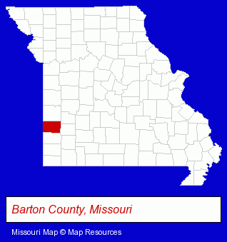
The Missouri counties map at upper right shows Barton County, highlighted in red. Use the menu below to display interactive maps of Lamar, either in a frame on this page or in full-screen mode.
Use the menu below to display categorized Lamar directories.
| Lamar Directory Page: | Schools |
|---|
Selected Lamar, Missouri Listings
These Lamar listings provide some insight into the city's cultural environment and economic climate.- Dentists
- Mortgages
- Mortgage & Loan Banks
- Escrow Services
- Heating & Air Conditioning Contractors
- Heating & Ventilating Contractors
- Appliance Dealers
- Excavation Contractors
- Commercial Printing
- Newspaper Publishers
- Public Schools
- Tires Retail
- Wheel & Tire Service & Repair
- Machine Shops
- Tool & Die Makers
Nearby Missouri Cities and Towns *
- Bolivar (1) - Bolivar, Missouri information and maps.
- Branson (8) - Branson, Missouri demographics and maps.
- Carthage (3) - Carthage, Missouri information and maps.
- Joplin (15) - Joplin, Missouri demographics and directory.
- Lees Summit (18) - Lees Summit, Missouri solutions directory and maps.
- Neosho (1) - Neosho, Missouri information and maps.
- Springfield (69) - Springfield, Missouri products & services directory.
* Parenthesized numbers indicate economic activity levels.
Copyright © 2011-2026 RegionalDirectory.us. All rights reserved.