Lees Summit, Missouri Map and Directory
Regional Directory > States Menu > Missouri
 According to the United States Census Bureau, Lees Summit is a City that is located primarily in Jackson County, Missouri at 38.92 degrees North and 94.38 degrees West.
The city's time zone is America/Chicago, and the city's primary telephone area code is 816.
The land area of Lees Summit is about 63.83 square miles, whereas the water area of the city is about 2.07 square miles.
According to the United States Census Bureau, Lees Summit is a City that is located primarily in Jackson County, Missouri at 38.92 degrees North and 94.38 degrees West.
The city's time zone is America/Chicago, and the city's primary telephone area code is 816.
The land area of Lees Summit is about 63.83 square miles, whereas the water area of the city is about 2.07 square miles.
The Census Bureau estimates that Lees Summit had about 93,864 residents in 2014, which is approximately 1,471 people per square mile of land area.
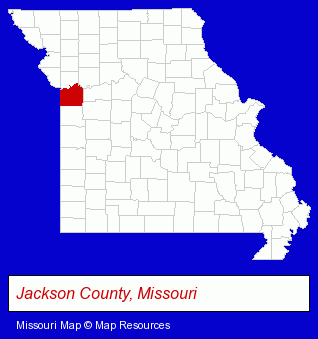
The Missouri counties map at upper right shows Jackson County, highlighted in red. Use the menu below to display interactive maps of Lees Summit, either in a frame on this page or in full-screen mode.
Use the menu below to display categorized Lees Summit directories.
| Lees Summit Products and Services Directory | ||
|---|---|---|
| Attorneys | Auto Insurance | Auto Service |
| Building Contractors | Building Materials | Business Insurance |
| Dentists | Financial Services | Home Improvement |
| Insurance | Physicians | Roofing Contractors |
Selected Lees Summit, Missouri Listings
These randomly selected Lees Summit listings in 64064 provide a window into the city's cultural environment and economic climate. ABI Corporation- Building & Home Construction
- Builders & Contractors
- Excavation Contractors
- Foundation Contractors
- Building Contractors
- Foundation Contractors
- Advertising & Promotional Product Dealers
- Commercial Signs
- Advertising Signs
- Letter Signs
- Importers
- Auto Body Repair & Painting
- Collision Services
- Long Distance Phone Services
- Telecommunications Services
- Mortgages
- Real Estate Loans
- Escrow Services
- Mortgage Brokers
- Insurance Agents & Brokers
- Business Insurance
- Medical Equipment & Supplies Retail
- Tanning Salons
- Tanning Salon Equipment & Supplies Retail
- Chiropractors
- Chiropractic Clinics
- Family & General Practice Physicians & Surgeons
- General Practice
- Pediatrics Physicians & Surgeons
- Allergy & Immunology Physicians & Surgeons
Nearby Missouri Cities and Towns *
- Belton (1) - Belton, Missouri information and maps.
- Blue Springs (8) - Blue Springs, Missouri demographics and maps.
- Grandview (3) - Grandview, Missouri information and maps.
- Independence (16) - Independence, Missouri demographics and directory.
- Kansas City (115) - Kansas City, Missouri products & services directory.
- Raymore (2) - Raymore, Missouri information and maps.
- Raytown (1) - Raytown, Missouri information and maps.
Large and Mid-size Cities in Nearby States
- Leawood, Kansas (19) - Leawood, KS demographics and directory.
- Overland Park, Kansas (51) - Overland Park, KS products & services directory.
* Parenthesized numbers indicate economic activity levels.
Copyright © 2011-2026 RegionalDirectory.us. All rights reserved.