Union, Missouri Map and Directory
Regional Directory > States Menu > Missouri
 According to the United States Census Bureau, Union is a City that is located in Franklin County, Missouri at 38.45 degrees North and 91.01 degrees West.
The city's time zone is America/Chicago, and the city's primary telephone area code is 636.
The land area of Union is about 9.09 square miles, whereas the water area of the city is about 0.00 square miles.
Franklin County's land area is about 923 square miles, so the city occupies about 1.0 percent of the county's total land area.
According to the United States Census Bureau, Union is a City that is located in Franklin County, Missouri at 38.45 degrees North and 91.01 degrees West.
The city's time zone is America/Chicago, and the city's primary telephone area code is 636.
The land area of Union is about 9.09 square miles, whereas the water area of the city is about 0.00 square miles.
Franklin County's land area is about 923 square miles, so the city occupies about 1.0 percent of the county's total land area.
The Census Bureau estimates that Union had about 11,990 residents in 2019, which is approximately 1,319 people per square mile of land area.
According to recent American Community Survey data, the median household income in Union was about $52,577 per year.
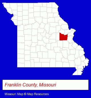
The Missouri counties map at upper right shows Franklin County, highlighted in red. Use the menu below to display interactive maps of Union, either in a frame on this page or in full-screen mode.
Use the menu below to display categorized Union directories.
| Union Directory Page: | Auto Service |
|---|
Selected Union, Missouri Listings
These Union listings provide some insight into the city's cultural environment and economic climate.- Chiropractors
- Plastic & Plastic Products Wholesale & Manufacturers
- Plastic Molders
- Plastic Molds Manufacturers
- Desktop Publishing
- Pet Grooming
- Pet Related Services
- Banks
- Mortgages
- Auto Dealers
- Truck Dealers
- Used Cars
- Insurance
- Attorneys
- Government Contractors
- Machine Shops
- Machine Tools Wholesale & Manufacturing
- Fabricated Structural Metal Manufacturers
- Real Estate Appraisers
- Funeral Services
- Funeral Homes & Directors
- Cemeteries & Memorial Parks
- Cremation Services
- Colleges & Universities
- Dentists
- Pediatrics Dentists
- Exercise & Fitness Classes & Instruction
- Gymnastics Instruction
- Insurance
- Surety & Fidelity Bonds
- Auto Parts Retail
- Machine Shops
- Recycling Centers
Nearby Missouri Cities and Towns *
- Ballwin (17) - Ballwin, Missouri solutions directory and maps.
- Chesterfield (29) - Chesterfield, Missouri solutions directory and maps.
- Fenton (15) - Fenton, Missouri demographics and directory.
- O Fallon (8) - O Fallon, Missouri demographics and maps.
- Wentzville (3) - Wentzville, Missouri information and maps.
* Parenthesized numbers indicate economic activity levels.
Copyright © 2011-2026 RegionalDirectory.us. All rights reserved.