Hampstead, North Carolina Map and Directory
Regional Directory > States Menu > North Carolina
 According to the United States Census Bureau, Hampstead is a Census-designated Place that is located in Pender County, North Carolina at 34.37 degrees North and 77.71 degrees West.
The place's time zone is America/New York, and the place's primary telephone area code is 910.
The land area of Hampstead is about 20.24 square miles, whereas the water area of the place is about 0.14 square miles.
Pender County's land area is about 870 square miles, so the place occupies about 2.3 percent of the county's total land area.
According to the United States Census Bureau, Hampstead is a Census-designated Place that is located in Pender County, North Carolina at 34.37 degrees North and 77.71 degrees West.
The place's time zone is America/New York, and the place's primary telephone area code is 910.
The land area of Hampstead is about 20.24 square miles, whereas the water area of the place is about 0.14 square miles.
Pender County's land area is about 870 square miles, so the place occupies about 2.3 percent of the county's total land area.
The Census Bureau estimates that Hampstead had about 5,901 residents in 2019, which is approximately 292 people per square mile of land area.
According to recent American Community Survey data, the median household income in Hampstead was about $78,333 per year.
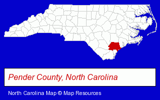
The North Carolina counties map at upper right shows Pender County, highlighted in red. Use the menu below to display interactive maps of Hampstead, either in a frame on this page or in full-screen mode.
Use the menu below to display categorized Hampstead directories.
| Hampstead Products and Services Directory | |
|---|---|
| Dentists | Recreation Centers |
Selected Hampstead, North Carolina Listings
These representative Hampstead listings provide some insight into the place's cultural environment and economic climate.- Counseling Services
- Counseling Centers
- Marine Equipment & Supplies Retail
- Marine Professionals & Services
- Boat & Yacht Cleaning & Detailing
- Sports & Recreation Facilities
- Health Clubs & Gyms
- Recreation Centers
- Marine Professionals & Services
- Ship Building & Repair
- Boat Builders & Wholesalers
- Sports & Recreation Facilities
- Health Clubs & Gyms
- Recreation Centers
- Air Conditioning Contractors
- Heating & Ventilating Contractors
- Refrigeration Dealers Commercial & Industrial
- Building & Home Construction
- Builders & Contractors
- Foundation Contractors
- Coffee & Tea Shops
- Beverages Wholesale & Manufacturers
- Coffee & Tea Wholesale & Manufacturers
- Building & Home Construction
- Architects
- Architectural Services
- Insurance
- Auto Insurance
- Property & Casualty Insurance
- Life Insurance
- Landscape Contractors
- Landscape Designers & Consultants
- Electric Contractors Residential
- Sports & Recreation Facilities
- Health Clubs & Gyms
- Recreation Centers
- Physicians & Surgeons
- Dentists
- Maxillofacial Physicians & Surgeons
- Auto Service & Repair
- Auto Body Repair & Painting
- Drug Stores & Pharmacies
Nearby North Carolina Cities and Towns *
- Carolina Beach (2) - Carolina Beach, North Carolina information and maps.
- Goldsboro (14) - Goldsboro, North Carolina demographics and directory.
- Jacksonville (10) - Jacksonville, North Carolina demographics and directory.
- New Bern (9) - New Bern, North Carolina demographics and directory.
- Southport (3) - Southport, North Carolina information and maps.
- Wilmington (80) - Wilmington, North Carolina products & services directory.
* Parenthesized numbers indicate economic activity levels.
Copyright © 2011-2026 RegionalDirectory.us. All rights reserved.