Huntersville, North Carolina Map and Directory
Regional Directory > States Menu > North Carolina
 According to the United States Census Bureau, Huntersville is a Town that is located in Mecklenburg County, North Carolina at 35.41 degrees North and 80.84 degrees West.
The town's time zone is America/New York, and the town's primary telephone area code is 704.
The land area of Huntersville is about 39.89 square miles, whereas the water area of the town is about 0.16 square miles.
Mecklenburg County's land area is about 524 square miles, so the town occupies about 7.6 percent of the county's total land area.
According to the United States Census Bureau, Huntersville is a Town that is located in Mecklenburg County, North Carolina at 35.41 degrees North and 80.84 degrees West.
The town's time zone is America/New York, and the town's primary telephone area code is 704.
The land area of Huntersville is about 39.89 square miles, whereas the water area of the town is about 0.16 square miles.
Mecklenburg County's land area is about 524 square miles, so the town occupies about 7.6 percent of the county's total land area.
The Census Bureau estimates that Huntersville had about 58,098 residents in 2019, which is approximately 1,456 people per square mile of land area.
According to recent American Community Survey data, the median household income in Huntersville was about $102,016 per year.
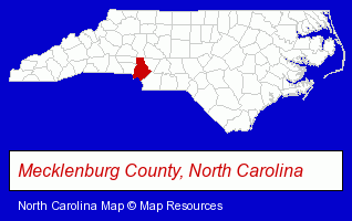
The North Carolina counties map at upper right shows Mecklenburg County, highlighted in red. Use the menu below to display interactive maps of Huntersville, either in a frame on this page or in full-screen mode.
Use the menu below to display categorized Huntersville directories.
| Huntersville Products and Services Directory | ||
|---|---|---|
| Accountants | Attorneys | Auto Dealers |
| Dentists | Health Clubs and Gyms | Home Improvement |
| Insurance | Landscape Contractors | Physicians |
| Recreation Centers | Restaurants | |
Selected Huntersville, North Carolina Listings
These randomly selected Huntersville listings provide some insight into the town's cultural environment and economic climate.- Florists
- Wedding Equipment & Supplies
- Gift Baskets & Packs Retail
- Wedding Supplies & Services
- General Practice
- Oncology Physicians & Surgeons
- Asian Restaurants
- Vegetarian Restaurants
- Podiatry Physicians & Surgeons
- Orthopedic Appliances Retail
- Homes & Residential Real Estate
- Property Management
- Real Estate Agencies & Brokerage
- Real Estate Agents
- Escrow Services
- Adult & Continuing Education
- Training Programs & Services
- Emergency Medical Training
- Cosmetic & Reconstructive Surgeons
- Homes & Residential Real Estate
- Real Estate Agencies & Brokerage
- Real Estate Agents
- Escrow Services
- Hotels
- Hotel & Motel Reservations
- Sports & Recreation Facilities
- Health Clubs & Gyms
- Recreation Centers
- Landscape Services
- Landscape Designers & Consultants
- Landscape Equipment & Supplies Dealers
- Sports & Recreation Facilities
- Recreation Centers
- Sports & Recreation Clubs & Organizations
- Stadiums & Arenas
Nearby North Carolina Cities and Towns *
- Charlotte (171) - Charlotte, North Carolina products & services directory.
- Concord (18) - Concord, North Carolina solutions directory and maps.
- Cornelius (10) - Cornelius, North Carolina demographics and directory.
- Davidson (1) - Davidson, North Carolina information and maps.
- Denver (5) - Denver, North Carolina demographics and maps.
- Kannapolis (1) - Kannapolis, North Carolina information and maps.
- Mooresville (14) - Mooresville, North Carolina demographics and directory.
Large and Mid-size Cities in Nearby States
- Rock Hill, South Carolina (7) - Rock Hill, SC demographics and maps.
* Parenthesized numbers indicate economic activity levels.
Copyright © 2011-2026 RegionalDirectory.us. All rights reserved.