Denver, North Carolina Map and Directory
Regional Directory > States Menu > North Carolina
 According to the United States Census Bureau, Denver is a Census-designated Place that is located in Lincoln County, North Carolina at 35.53 degrees North and 81.03 degrees West.
The place's time zone is America/New York, and the place's primary telephone area code is 704.
The land area of Denver is about 6.21 square miles, whereas the water area of the place is about 0.01 square miles.
Lincoln County's land area is about 298 square miles, so the place occupies about 2.1 percent of the county's total land area.
According to the United States Census Bureau, Denver is a Census-designated Place that is located in Lincoln County, North Carolina at 35.53 degrees North and 81.03 degrees West.
The place's time zone is America/New York, and the place's primary telephone area code is 704.
The land area of Denver is about 6.21 square miles, whereas the water area of the place is about 0.01 square miles.
Lincoln County's land area is about 298 square miles, so the place occupies about 2.1 percent of the county's total land area.
The Census Bureau estimates that Denver had about 1,837 residents in 2014, which is approximately 296 people per square mile of land area.
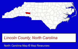
The North Carolina counties map at upper right shows Lincoln County, highlighted in red. Use the menu below to display interactive maps of Denver, either in a frame on this page or in full-screen mode.
Use the menu below to display categorized Denver directories.
| Denver Products and Services Directory | ||
|---|---|---|
| Attorneys | Building Contractors | Building Materials |
| Chiropractors | Recreation Centers | |
Selected Denver, North Carolina Listings
These randomly selected Denver listings provide some insight into the place's cultural environment and economic climate.- Pet Grooming
- Optometrists
- Contact Lenses
- Marinas
- Docks
- Garage Doors & Openers
- Garage Door Repair
- Health Clubs & Gyms
- Recreation Centers
- Builders & Contractors
- Building Contractors
- Dentists
- Orthodontics Dentists
- Health Clubs & Gyms
- Recreation Centers
- Utilities
- Fuels Retail
- Propane & Natural Gas
- Gas Companies
- Burglar Alarms Wholesale & Manufacturers
- Builders & Contractors
- Building Contractors
- Sports & Recreation Facilities
- Health Clubs & Gyms
- Recreation Centers
Nearby North Carolina Cities and Towns *
- Conover (3) - Conover, North Carolina information and maps.
- Cornelius (10) - Cornelius, North Carolina demographics and directory.
- Davidson (1) - Davidson, North Carolina information and maps.
- Huntersville (11) - Huntersville, North Carolina demographics and directory.
- Lincolnton (1) - Lincolnton, North Carolina information and maps.
- Mooresville (14) - Mooresville, North Carolina demographics and directory.
- Statesville (10) - Statesville, North Carolina demographics and directory.
* Parenthesized numbers indicate economic activity levels.
Copyright © 2011-2026 RegionalDirectory.us. All rights reserved.