Kill Devil Hills, North Carolina Map and Directory
Regional Directory > States Menu > North Carolina
 According to the United States Census Bureau, Kill Devil Hills is a Town that is located in Dare County, North Carolina at 36.03 degrees North and 75.68 degrees West.
The town's time zone is America/New York, and the town's primary telephone area code is 252.
The land area of Kill Devil Hills is about 5.62 square miles, whereas the water area of the town is about 0.06 square miles.
Dare County's land area is about 383 square miles, so the town occupies about 1.5 percent of the county's total land area.
According to the United States Census Bureau, Kill Devil Hills is a Town that is located in Dare County, North Carolina at 36.03 degrees North and 75.68 degrees West.
The town's time zone is America/New York, and the town's primary telephone area code is 252.
The land area of Kill Devil Hills is about 5.62 square miles, whereas the water area of the town is about 0.06 square miles.
Dare County's land area is about 383 square miles, so the town occupies about 1.5 percent of the county's total land area.
The Census Bureau estimates that Kill Devil Hills had about 7,333 residents in 2019, which is approximately 1,305 people per square mile of land area.
According to recent American Community Survey data, the median household income in Kill Devil Hills was about $53,750 per year.
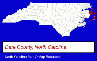
The North Carolina counties map at upper right shows Dare County, highlighted in red. Use the menu below to display interactive maps of Kill Devil Hills, either in a frame on this page or in full-screen mode.
Use the menu below to display categorized Kill Devil Hills directories.
| Kill Devil Hills Products and Services Directory | ||
|---|---|---|
| Building Materials | Home Improvement | Hotels |
| Restaurants | Seafood Restaurants | |
Selected Kill Devil Hills, North Carolina Listings
These randomly selected Kill Devil Hills listings provide some insight into the town's cultural environment and economic climate.- Printing Services
- Commercial Printing
- Screen Printing
- Painting Contractors
- Bar & Grill Restaurants
- Seafood Restaurants
- Raw Bar Restaurants
- Hunting
- Steak Restaurants
- Printing Services
- Government Contractors
- Copying & Duplicating Services
- Telecommunications Services
- Fax Services
- Plumbing Contractors
- Plumbing & Heating Contractors
- Licensed Plumbing Contractors
- Plumbing Contractors Commercial & Industrial
- Building & Home Construction
- Special Trades Contractors
- Painting Contractors
- Painting Contractors Commercial & Industrial
- Auto Insurance
- Property & Casualty Insurance
- Life Insurance
- Pet Sitting & Day Care
- Pet Grooming
- Landscape Contractors
- Tree Services Commercial & Industrial
- Water Sports Equipment & Supplies Dealers
- Lodging
- Hotels
- Motels
- Banquet Facilities
- Attorneys
- Personal Injury Attorneys
- Employment & Labor Law Attorneys
- Lawyers - Employment & Labor Law
- Information Technology Services
- Computer Software
- Computer & Equipment Dealers
- Computer & Software Stores
Nearby North Carolina Cities and Towns *
- Buxton (1) - Buxton, North Carolina information and maps.
- Elizabeth City (2) - Elizabeth City, North Carolina information and maps.
- Hatteras (1) - Hatteras, North Carolina information and maps.
- Kitty Hawk (1) - Kitty Hawk, North Carolina information and maps.
- Manteo (1) - Manteo, North Carolina information and maps.
- Nags Head (5) - Nags Head, North Carolina demographics and maps.
- Wanchese (2) - Wanchese, North Carolina information and maps.
Large and Mid-size Cities in Nearby States
- Virginia Beach, Virginia (37) - Virginia Beach, VA solutions directory and maps.
* Parenthesized numbers indicate economic activity levels.
Copyright © 2011-2026 RegionalDirectory.us. All rights reserved.