Nags Head, North Carolina Map and Directory
Regional Directory > States Menu > North Carolina
 According to the United States Census Bureau, Nags Head is a Town that is located in Dare County, North Carolina at 35.96 degrees North and 75.62 degrees West.
The town's time zone is America/New York, and the town's primary telephone area code is 252.
The land area of Nags Head is about 6.58 square miles, whereas the water area of the town is about 0.08 square miles.
Dare County's land area is about 383 square miles, so the town occupies about 1.7 percent of the county's total land area.
According to the United States Census Bureau, Nags Head is a Town that is located in Dare County, North Carolina at 35.96 degrees North and 75.62 degrees West.
The town's time zone is America/New York, and the town's primary telephone area code is 252.
The land area of Nags Head is about 6.58 square miles, whereas the water area of the town is about 0.08 square miles.
Dare County's land area is about 383 square miles, so the town occupies about 1.7 percent of the county's total land area.
The Census Bureau estimates that Nags Head had about 2,840 residents in 2014, which is approximately 432 people per square mile of land area.
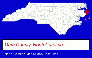
The North Carolina counties map at upper right shows Dare County, highlighted in red. Use the menu below to display interactive maps of Nags Head, either in a frame on this page or in full-screen mode.
Use the menu below to display categorized Nags Head directories.
| Nags Head Products and Services Directory | ||
|---|---|---|
| Clothing Stores | Hotels | Restaurants |
| Take Out | Vacation Home Rental | |
Selected Nags Head, North Carolina Listings
These randomly selected Nags Head listings provide some insight into the town's cultural environment and economic climate.- Building & Home Construction
- Building Contractors
- Construction Companies
- Siding Contractors
- Bathroom Planning & Remodeling
- Office Supplies Retail
- Gift Shops
- Stationery Retail
- Radio Stations
- Cabin, Cottage & Chalet Rental
- Lodging
- Hotels
- Motels
- Visual Arts
- Photography
- Professional Photographers
- Portrait Photographers
- Insurance
- Building Contractors
- Kitchen Design & Remodeling Services
- Steak Restaurants
- Bars & Pubs
- Optical Goods Retail
- Contact Lenses
- Lodging
- Hotels
- Motels
- Vacation Home Rental
- Cabin, Cottage & Chalet Rental
- Clothing & Accessories Retail
- Shoe Stores
- Antiques
- Antique Dealers
Nearby North Carolina Cities and Towns *
- Buxton (1) - Buxton, North Carolina information and maps.
- Elizabeth City (2) - Elizabeth City, North Carolina information and maps.
- Hatteras (1) - Hatteras, North Carolina information and maps.
- Kill Devil Hills (5) - Kill Devil Hills, North Carolina demographics and maps.
- Kitty Hawk (1) - Kitty Hawk, North Carolina information and maps.
- Manteo (1) - Manteo, North Carolina information and maps.
- Wanchese (2) - Wanchese, North Carolina information and maps.
* Parenthesized numbers indicate economic activity levels.
Copyright © 2011-2026 RegionalDirectory.us. All rights reserved.