Winston Salem, North Carolina Map and Directory
Regional Directory > States Menu > North Carolina
 According to the United States Census Bureau, Winston Salem is a City that is located in Forsyth County, North Carolina at 36.10 degrees North and 80.24 degrees West.
The city's time zone is America/New York, and the city's primary telephone area code is 336.
The land area of Winston Salem is about 132.50 square miles, whereas the water area of the city is about 1.23 square miles.
Forsyth County's land area is about 408 square miles, so the city occupies about 32.5 percent of the county's total land area.
According to the United States Census Bureau, Winston Salem is a City that is located in Forsyth County, North Carolina at 36.10 degrees North and 80.24 degrees West.
The city's time zone is America/New York, and the city's primary telephone area code is 336.
The land area of Winston Salem is about 132.50 square miles, whereas the water area of the city is about 1.23 square miles.
Forsyth County's land area is about 408 square miles, so the city occupies about 32.5 percent of the county's total land area.
The Census Bureau estimates that Winston Salem had about 239,269 residents in 2014, which is approximately 1,806 people per square mile of land area.
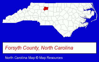
The North Carolina counties map at upper right shows Forsyth County, highlighted in red. Use the menu below to display interactive maps of Winston Salem, either in a frame on this page or in full-screen mode.
Use the menu below to display categorized Winston Salem directories.
| Winston Salem Products and Services Directory | ||
|---|---|---|
| Accountants | Attorneys | Auto Service |
| Building Contractors | Building Materials | Business Services |
| Chiropractors | Clinics | Dentists |
| Financial Services | Home Furnishings | Home Improvement |
| Insurance | Movers | Moving and Storage |
| Physicians | Restaurants | Schools |
| Security Systems | ||
Selected Winston Salem, North Carolina Listings
These randomly selected Winston Salem listings provide some insight into the city's cultural environment and economic climate.- Adult & Continuing Education
- Computer Training
- Software Training
- Other Schools & Instruction
- Driver Training
- Defensive Driving Instruction
- Traffic Schools
- Engineers
- Environmental Engineers
- Interior Decorators & Designers
- Design
- Barbecue Restaurants
- Travel Agents
- Travel Industry
- Business Consultants & Advisors
- Security Consultants & Agencies
- Burglar Alarms Wholesale & Manufacturers
- Hotel & Motel Reservations
- Electric Contractors Residential
- Auto Engine Service & Repair
- Civic Clubs & Organizations
- Sports & Recreation Clubs & Organizations
- Private Golf Courses
- Country Clubs
- Maxillofacial Physicians & Surgeons
- Endodontics Dentists
- Prosthodontics Dentists
- Fish & Seafood Retail
- Government Contractors
- Cabinet Dealers
- Cabinets & Cabinet Makers Residential
- Cabinets Wholesale & Manufacturers
Nearby North Carolina Cities and Towns *
- Clemmons (2) - Clemmons, North Carolina information and maps.
- Greensboro (96) - Greensboro, North Carolina products & services directory.
- High Point (26) - High Point, North Carolina solutions directory and maps.
- Kernersville (4) - Kernersville, North Carolina information and maps.
- Lexington (4) - Lexington, North Carolina information and maps.
- Mocksville (1) - Mocksville, North Carolina information and maps.
- Thomasville (1) - Thomasville, North Carolina information and maps.
* Parenthesized numbers indicate economic activity levels.
Copyright © 2011-2026 RegionalDirectory.us. All rights reserved.