Mocksville, North Carolina Map and Directory
Regional Directory > States Menu > North Carolina
 According to the United States Census Bureau, Mocksville is a Town that is located in Davie County, North Carolina at 35.89 degrees North and 80.56 degrees West.
The town's time zone is America/New York, and the town's primary telephone area code is 336.
The land area of Mocksville is about 7.60 square miles, whereas the water area of the town is about 0.02 square miles.
Davie County's land area is about 264 square miles, so the town occupies about 2.9 percent of the county's total land area.
According to the United States Census Bureau, Mocksville is a Town that is located in Davie County, North Carolina at 35.89 degrees North and 80.56 degrees West.
The town's time zone is America/New York, and the town's primary telephone area code is 336.
The land area of Mocksville is about 7.60 square miles, whereas the water area of the town is about 0.02 square miles.
Davie County's land area is about 264 square miles, so the town occupies about 2.9 percent of the county's total land area.
The Census Bureau estimates that Mocksville had about 5,252 residents in 2019, which is approximately 691 people per square mile of land area.
According to recent American Community Survey data, the median household income in Mocksville was about $42,872 per year.
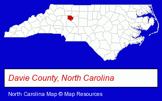
The North Carolina counties map at upper right shows Davie County, highlighted in red. Use the menu below to display interactive maps of Mocksville, either in a frame on this page or in full-screen mode.
Use the menu below to display categorized Mocksville directories.
| Mocksville Directory Page: | Veterinarians |
|---|
Selected Mocksville, North Carolina Listings
These Mocksville listings provide some insight into the town's cultural environment and economic climate.- Pet Care Services
- Animal Shelters
- Humane Societies
- Building & Home Construction
- Building Contractors
- Government Contractors
- Construction Companies
- Grain Elevators
- Building Contractors
- Architects
- Architectural Engineers
- Wedding Equipment & Supplies
- Gift Baskets & Packs Retail
- Wedding Supplies & Services
- Gift Shops
- Take Out
- Bakeries
- Gift Baskets & Packs Retail
- Delicatessens
- Auto Service & Repair
- Auto Cleaning & Detailing
- Clinics & Medical Centers
- Veterinarians
- Animal Hospitals
- Animal Health
Nearby North Carolina Cities and Towns *
- Concord (18) - Concord, North Carolina solutions directory and maps.
- High Point (26) - High Point, North Carolina solutions directory and maps.
- Lexington (4) - Lexington, North Carolina information and maps.
- Mooresville (14) - Mooresville, North Carolina demographics and directory.
- Salisbury (12) - Salisbury, North Carolina demographics and directory.
- Statesville (10) - Statesville, North Carolina demographics and directory.
- Winston Salem (61) - Winston Salem, North Carolina products & services directory.
* Parenthesized numbers indicate economic activity levels.
Copyright © 2011-2026 RegionalDirectory.us. All rights reserved.