Fargo, North Dakota Map and Directory
Regional Directory > States Menu > North Dakota
 According to the United States Census Bureau, Fargo is a City that is located in Cass County, North Dakota at 46.88 degrees North and 96.79 degrees West.
The city's time zone is America/Chicago, and the city's primary telephone area code is 701.
The land area of Fargo is about 48.94 square miles, whereas the water area of the city is about 0.00 square miles.
Cass County's land area is about 1,765 square miles, so the city occupies about 2.8 percent of the county's total land area.
According to the United States Census Bureau, Fargo is a City that is located in Cass County, North Dakota at 46.88 degrees North and 96.79 degrees West.
The city's time zone is America/Chicago, and the city's primary telephone area code is 701.
The land area of Fargo is about 48.94 square miles, whereas the water area of the city is about 0.00 square miles.
Cass County's land area is about 1,765 square miles, so the city occupies about 2.8 percent of the county's total land area.
The Census Bureau estimates that Fargo had about 124,662 residents in 2019, which is approximately 2,547 people per square mile of land area.
According to recent American Community Survey data, the median household income in Fargo was about $55,551 per year.
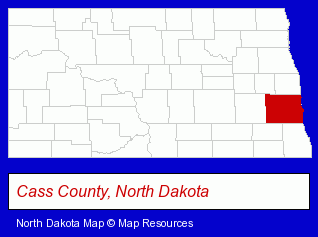
The North Dakota counties map at upper right shows Cass County, highlighted in red. Use the menu below to display interactive maps of Fargo, either in a frame on this page or in full-screen mode.
Use the menu below to display categorized Fargo directories.
Selected Fargo, North Dakota Listings
These randomly selected Fargo listings provide some insight into the city's cultural environment and economic climate.- Movers
- Household Goods & Furniture Storage
- Corrugated & Fiber Boxes Retail
- Courier & Delivery Services Residential
- Musical Instruments Retail
- Musical Instrument Service & Repair
- Musical Instrument Rental & Leasing
- Nurseries
- Flower Wholesalers
- Insurance Adjusters
- Motels
- Convention & Meeting Facilities & Services
- Internet Services
- Internet Service Providers
- Telecommunications Services
- DSL Services
- Optical Goods Retail
- Contact Lenses
- Radon Testing & Mitigation
- Waterproofing Contractors
- Government Contractors
- Advertising Agencies & Consultants
- Advertising & Design Agencies
- Phone Equipment & Systems Dealers
- Phone Equipment & Systems Service & Repair
- Radio Sales & Service
- Telecommunications Equipment
- Building & Home Construction
- Electric Contractors
- Electric Contractors Residential
- Bicycle Dealers
- Motorcycle, Motor Scooter & ATV Service & Repair
- Motorcycle, Motor Scooter & Minibike Parts & Accessories
- Machine Shops
- Metal Fabricators
- Welding Services
- Fabricated Structural Metal Manufacturers
- Video Equipment, Parts & Supplies Retail
- Radio Sales & Service
- Televisions Retail
- Auto Alarms & Security Systems
- Car Audio & Video Retail
- Engineers
- Electrical Engineers
Nearby North Dakota Cities and Towns *
- Bismarck (31) - Bismarck, North Dakota solutions directory and maps.
- Devils Lake (2) - Devils Lake, North Dakota information and maps.
- Grand Forks (13) - Grand Forks, North Dakota demographics and directory.
- Minot (9) - Minot, North Dakota demographics and directory.
* Parenthesized numbers indicate economic activity levels.
Copyright © 2011-2026 RegionalDirectory.us. All rights reserved.