Exeter, New Hampshire Map and Directory
Regional Directory > States Menu > New Hampshire
 According to the United States Census Bureau, Exeter is a Town that is located in Rockingham County, New Hampshire at 42.99 degrees North and 70.96 degrees West.
The town's time zone is America/New York, and the town's primary telephone area code is 603.
The land area of Exeter is about 19.56 square miles, whereas the water area of the town is about 0.38 square miles.
Rockingham County's land area is about 695 square miles, so the town occupies about 2.8 percent of the county's total land area.
According to the United States Census Bureau, Exeter is a Town that is located in Rockingham County, New Hampshire at 42.99 degrees North and 70.96 degrees West.
The town's time zone is America/New York, and the town's primary telephone area code is 603.
The land area of Exeter is about 19.56 square miles, whereas the water area of the town is about 0.38 square miles.
Rockingham County's land area is about 695 square miles, so the town occupies about 2.8 percent of the county's total land area.
The Census Bureau estimates that Exeter had about 15,077 residents in 2019, which is approximately 771 people per square mile of land area.
According to recent American Community Survey data, the median household income in Exeter was about $77,120 per year.
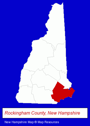
The New Hampshire counties map at upper right shows Rockingham County, highlighted in red. Use the menu below to display interactive maps of Exeter, either in a frame on this page or in full-screen mode.
Use the menu below to display categorized Exeter directories.
| Exeter Products and Services Directory | ||
|---|---|---|
| Dentists | Physicians | Restaurants |
| Visual Arts | ||
Selected Exeter, New Hampshire Listings
These randomly selected Exeter listings provide some insight into the town's cultural environment and economic climate.- Orthodontics Dentists
- Cosmetic Dentists
- Oral Surgeons
- Electric Equipment & Supplies Dealers
- Electronic Equipment & Supplies Wholesale & Manufacturers
- Moving & Storage
- Movers
- Household Goods & Furniture Storage
- Household Goods Moving & Storage
- Art Galleries & Dealers
- Crafts & Craft Supplies Retail
- Carpet & Rug Dealers
- Engineers
- Environmental Engineers
- Excavation Contractors
- Antiques
- Antique Dealers
- Schools
- Elementary & Secondary Education
- Elementary Schools
- Private Schools
- Mechanical Contractors
- Mechanical Engineers
Nearby New Hampshire Cities and Towns *
- Dover (3) - Dover, New Hampshire information and maps.
- Durham (1) - Durham, New Hampshire information and maps.
- Hampton (2) - Hampton, New Hampshire information and maps.
- Kingston (1) - Kingston, New Hampshire information and maps.
- Plaistow (2) - Plaistow, New Hampshire information and maps.
- Portsmouth (24) - Portsmouth, New Hampshire solutions directory and maps.
- Salem (14) - Salem, New Hampshire demographics and directory.
Large and Mid-size Cities in Nearby States
- Haverhill, Massachusetts (8) - Haverhill, MA demographics and maps.
- Newburyport, Massachusetts (13) - Newburyport, MA demographics and directory.
* Parenthesized numbers indicate economic activity levels.
Copyright © 2011-2026 RegionalDirectory.us. All rights reserved.