Dover, New Hampshire Map and Directory
Regional Directory > States Menu > New Hampshire
 According to the United States Census Bureau, Dover is a City that is located in Strafford County, New Hampshire at 43.20 degrees North and 70.87 degrees West.
The city's time zone is America/New York, and the city's primary telephone area code is 603.
The land area of Dover is about 26.71 square miles, whereas the water area of the city is about 2.31 square miles.
Strafford County's land area is about 369 square miles, so the city occupies about 7.2 percent of the county's total land area.
According to the United States Census Bureau, Dover is a City that is located in Strafford County, New Hampshire at 43.20 degrees North and 70.87 degrees West.
The city's time zone is America/New York, and the city's primary telephone area code is 603.
The land area of Dover is about 26.71 square miles, whereas the water area of the city is about 2.31 square miles.
Strafford County's land area is about 369 square miles, so the city occupies about 7.2 percent of the county's total land area.
The Census Bureau estimates that Dover had about 32,191 residents in 2019, which is approximately 1,205 people per square mile of land area.
According to recent American Community Survey data, the median household income in Dover was about $71,631 per year.
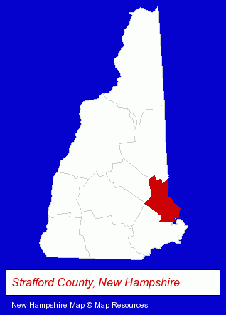
The New Hampshire counties map at upper right shows Strafford County, highlighted in red. Use the menu below to display interactive maps of Dover, either in a frame on this page or in full-screen mode.
Use the menu below to display categorized Dover directories.
| Dover Products and Services Directory | ||
|---|---|---|
| Dentists | Physicians | Restaurants |
Selected Dover, New Hampshire Listings
These representative Dover listings provide some insight into the city's cultural environment and economic climate.- Home Improvement & Maintenance
- Building & Home Construction
- Architects
- Architectural Services
- Interior Decorators & Designers
- Electronic Equipment & Supplies Wholesale & Manufacturers
- Electronic Component Manufacturers
- Government Contractors
- Surgical Instruments Wholesale & Manufacturers
- Hospital Supplies
- Metals
- Importers
- Metal Products
- Metal Products Wholesale & Manufacturers
- Podiatry Physicians & Surgeons
- Pediatrics Physicians & Surgeons
- General Practice
- Caterers
- American Restaurants
- Bar & Grill Restaurants
- Take Out
- Moving & Storage
- Moving & Storage Commercial & Industrial
- Packaging & Shipping Materials Retail
- Packaging & Shipping Services
- Packing & Crating Materials
- Carpet & Rug Dealers
- Ceramic Tiles
- Floor Resurfacing Materials
- Engineers
- Medical Equipment & Supplies Retail
- Laboratories
- Engineering Services
- Pizza Restaurants
- Commercial Printing
- Photofinishing Retail
- Photo Retouching & Coloring
- Passport & Identification Photographers
- Digital Imaging
- Building Contractors
- Roofing Contractors
- Roofing Consultants
- Metal Roofing Contractors
- Office Supplies Retail
Nearby New Hampshire Cities and Towns *
- Durham (1) - Durham, New Hampshire information and maps.
- Exeter (4) - Exeter, New Hampshire information and maps.
- Farmington (1) - Farmington, New Hampshire information and maps.
- Hampton (2) - Hampton, New Hampshire information and maps.
- Portsmouth (24) - Portsmouth, New Hampshire solutions directory and maps.
- Rochester (1) - Rochester, New Hampshire information and maps.
- Somersworth (1) - Somersworth, New Hampshire information and maps.
* Parenthesized numbers indicate economic activity levels.
Copyright © 2011-2026 RegionalDirectory.us. All rights reserved.