Laconia, New Hampshire Map and Directory
Regional Directory > States Menu > New Hampshire
 According to the United States Census Bureau, Laconia is a City that is located in Belknap County, New Hampshire at 43.53 degrees North and 71.47 degrees West.
The city's time zone is America/New York, and the city's primary telephone area code is 603.
The land area of Laconia is about 19.82 square miles, whereas the water area of the city is about 6.14 square miles.
Belknap County's land area is about 400 square miles, so the city occupies about 5.0 percent of the county's total land area.
According to the United States Census Bureau, Laconia is a City that is located in Belknap County, New Hampshire at 43.53 degrees North and 71.47 degrees West.
The city's time zone is America/New York, and the city's primary telephone area code is 603.
The land area of Laconia is about 19.82 square miles, whereas the water area of the city is about 6.14 square miles.
Belknap County's land area is about 400 square miles, so the city occupies about 5.0 percent of the county's total land area.
The Census Bureau estimates that Laconia had about 16,581 residents in 2019, which is approximately 837 people per square mile of land area.
According to recent American Community Survey data, the median household income in Laconia was about $57,960 per year.
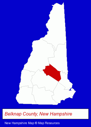
The New Hampshire counties map at upper right shows Belknap County, highlighted in red. Use the menu below to display interactive maps of Laconia, either in a frame on this page or in full-screen mode.
Use the menu below to display categorized Laconia directories.
| Laconia Products and Services Directory | ||
|---|---|---|
| Building Contractors | Hotels | Printing and Publishing |
| Restaurants | ||
Selected Laconia, New Hampshire Listings
These randomly selected Laconia listings provide some insight into the city's cultural environment and economic climate.- Heating & Ventilating Contractors
- Air Duct Cleaning
- Towing
- Boat & Yacht Charters, Rental & Leasing
- Marine Equipment & Supplies Retail
- House & Pontoon Boats Rental
- Lodging
- Hotels
- Museums
- Auto Dealers
- Janitorial Services
- Florists
- Gift Shops
- Gift Baskets & Packs Retail
- Card Shops
- Souvenir & Novelty Shops
- Construction Companies
- Commercial & Industrial Building Contractors
- Architects
- Architectural Engineers
- Travel Agents
- Cruise Lines & Agents
- Auto Service & Repair
- Tires Retail
- Industrial Equipment & Supplies Wholesale & Manufacturers
- Industrial Equipment Parts & Accessories Wholesale & Manufacturers
- Aircraft Parts & Equipment Wholesale & Manufacturers
- Caterers
- American Restaurants
- Hotel & Motel Reservations
Nearby New Hampshire Cities and Towns *
- Bedford (10) - Bedford, New Hampshire demographics and directory.
- Belmont (1) - Belmont, New Hampshire information and maps.
- Concord (23) - Concord, New Hampshire solutions directory and maps.
- Hebron (2) - Hebron, New Hampshire information and maps.
- Manchester (39) - Manchester, New Hampshire products & services directory.
- Meredith (1) - Meredith, New Hampshire information and maps.
- Wolfeboro (1) - Wolfeboro, New Hampshire information and maps.
* Parenthesized numbers indicate economic activity levels.
Copyright © 2011-2026 RegionalDirectory.us. All rights reserved.