Wolfeboro, New Hampshire Map and Directory
Regional Directory > States Menu > New Hampshire
 According to the United States Census Bureau, Wolfeboro is a Town that is located in Carroll County, New Hampshire at 43.60 degrees North and 71.18 degrees West.
The town's time zone is America/New York, and the town's primary telephone area code is 603.
The land area of Wolfeboro is about 47.87 square miles, whereas the water area of the town is about 10.57 square miles.
Carroll County's land area is about 931 square miles, so the town occupies about 5.1 percent of the county's total land area.
According to the United States Census Bureau, Wolfeboro is a Town that is located in Carroll County, New Hampshire at 43.60 degrees North and 71.18 degrees West.
The town's time zone is America/New York, and the town's primary telephone area code is 603.
The land area of Wolfeboro is about 47.87 square miles, whereas the water area of the town is about 10.57 square miles.
Carroll County's land area is about 931 square miles, so the town occupies about 5.1 percent of the county's total land area.
The Census Bureau estimates that Wolfeboro had about 6,320 residents in 2019, which is approximately 132 people per square mile of land area.
According to recent American Community Survey data, the median household income in Wolfeboro was about $60,703 per year.
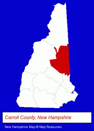
The New Hampshire counties map at upper right shows Carroll County, highlighted in red. Use the menu below to display interactive maps of Wolfeboro, either in a frame on this page or in full-screen mode.
Use the menu below to display categorized Wolfeboro directories.
| Wolfeboro Directory Page: | Home Improvement |
|---|
Selected Wolfeboro, New Hampshire Listings
These Wolfeboro listings provide some insight into the town's cultural environment and economic climate.- Printing & Publishing
- Printing Services
- Screen Printing
- Charitable & Nonprofit Organizations
- Resorts & Vacation Cottages
- Vacation Home Rental
- Cabin, Cottage & Chalet Rental
- Landscape Contractors
- Landscape Services
- Hotels
- Motels
- Attorneys
- Lodging
- Hotels
- Motels
- Vacation Home Rental
- Cabin, Cottage & Chalet Rental
- Weddings
- Wedding Services
- Wedding Planners
- Attorneys
- Administrative & Governmental Law Attorneys
- Home Health Care
- Hospice Services
- Attendant Home Care Hospices
- Veterinarians
Nearby New Hampshire Cities and Towns *
- Belmont (1) - Belmont, New Hampshire information and maps.
- Concord (23) - Concord, New Hampshire solutions directory and maps.
- Farmington (1) - Farmington, New Hampshire information and maps.
- Laconia (4) - Laconia, New Hampshire information and maps.
- Meredith (1) - Meredith, New Hampshire information and maps.
- Rochester (1) - Rochester, New Hampshire information and maps.
* Parenthesized numbers indicate economic activity levels.
Copyright © 2011-2026 RegionalDirectory.us. All rights reserved.