Merrimack, New Hampshire Map and Directory
Regional Directory > States Menu > New Hampshire
 According to the United States Census Bureau, Merrimack is a Town that is located in Hillsborough County, New Hampshire at 42.85 degrees North and 71.52 degrees West.
The town's time zone is America/New York, and the town's primary telephone area code is 603.
The land area of Merrimack is about 32.54 square miles, whereas the water area of the town is about 0.87 square miles.
Hillsborough County's land area is about 876 square miles, so the town occupies about 3.7 percent of the county's total land area.
According to the United States Census Bureau, Merrimack is a Town that is located in Hillsborough County, New Hampshire at 42.85 degrees North and 71.52 degrees West.
The town's time zone is America/New York, and the town's primary telephone area code is 603.
The land area of Merrimack is about 32.54 square miles, whereas the water area of the town is about 0.87 square miles.
Hillsborough County's land area is about 876 square miles, so the town occupies about 3.7 percent of the county's total land area.
The Census Bureau estimates that Merrimack had about 25,987 residents in 2019, which is approximately 799 people per square mile of land area.
According to recent American Community Survey data, the median household income in Merrimack was about $107,232 per year.
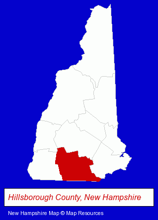
The New Hampshire counties map at upper right shows Hillsborough County, highlighted in red. Use the menu below to display interactive maps of Merrimack, either in a frame on this page or in full-screen mode.
Use the menu below to display categorized Merrimack directories.
| Merrimack Products and Services Directory | ||
|---|---|---|
| Building Contractors | Dentists | Insurance |
| Landscape Contractors | Masonry Contractors | Restaurants |
| Schools | ||
Selected Merrimack, New Hampshire Listings
These randomly selected Merrimack listings provide some insight into the town's cultural environment and economic climate.- Auto Parts Wholesale & Manufacturers
- Title Insurance
- Real Estate Title Search & Abstract Services
- Tires Wholesale & Manufacturers
- Electronic Equipment & Supplies Wholesale & Manufacturers
- Engineers
- Environmental Engineers
- Funeral Services
- Funeral Homes & Directors
- Cemeteries & Memorial Parks
- Cemeteries & Crematories
- Cremation Services
- Floors & Flooring Contractors
- Chemicals Wholesale & Manufacturers
- Chemicals - Manufacturers
- Sealers
- Painting Contractors
- Auto Insurance
- Auto Service & Repair
- Towing
- Chambers of Commerce
- Water & Sewage Companies
- Water Utility Companies
- Landscape Services
- Agricultural Equipment & Supplies Retail
- Lawn & Garden Sprinklers Installation & Service
- Lawn & Garden Equipment Service & Repair
- Music Instruction
- Instrumental Music Instruction
- Piano Instruction
- Shoe Stores
- Charitable & Nonprofit Organizations
- Colleges & Universities
- Vocational Education
- Educational Services
- Aircraft Parts & Equipment Retail
Nearby New Hampshire Cities and Towns *
- Amherst (7) - Amherst, New Hampshire demographics and maps.
- Bedford (10) - Bedford, New Hampshire demographics and directory.
- Hudson (4) - Hudson, New Hampshire information and maps.
- Londonderry (4) - Londonderry, New Hampshire information and maps.
- Manchester (39) - Manchester, New Hampshire products & services directory.
- Milford (1) - Milford, New Hampshire information and maps.
- Nashua (20) - Nashua, New Hampshire solutions directory and maps.
Large and Mid-size Cities in Nearby States
- Lowell, Massachusetts (12) - Lowell, MA demographics and maps.
* Parenthesized numbers indicate economic activity levels.
Copyright © 2011-2026 RegionalDirectory.us. All rights reserved.