Denville, New Jersey Map and Directory
Regional Directory > States Menu > New Jersey
 According to the United States Census Bureau, Denville is a Township that is located in Morris County, New Jersey at 40.89 degrees North and 74.49 degrees West.
The township's time zone is America/New York, and the township's primary telephone area code is 973.
The land area of Denville is about 11.98 square miles, whereas the water area of the township is about 0.77 square miles.
Morris County's land area is about 460 square miles, so the township occupies about 2.6 percent of the county's total land area.
According to the United States Census Bureau, Denville is a Township that is located in Morris County, New Jersey at 40.89 degrees North and 74.49 degrees West.
The township's time zone is America/New York, and the township's primary telephone area code is 973.
The land area of Denville is about 11.98 square miles, whereas the water area of the township is about 0.77 square miles.
Morris County's land area is about 460 square miles, so the township occupies about 2.6 percent of the county's total land area.
The Census Bureau estimates that Denville had about 16,606 residents in 2019, which is approximately 1,386 people per square mile of land area.
According to recent American Community Survey data, the median household income in Denville was about $125,655 per year.
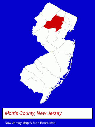
The New Jersey counties map at upper right shows Morris County, highlighted in red. Use the menu below to display interactive maps of Denville, either in a frame on this page or in full-screen mode.
Use the menu below to display categorized Denville directories.
| Denville Products and Services Directory | ||
|---|---|---|
| Attorneys | Clothing Stores | Printing and Publishing |
Selected Denville, New Jersey Listings
These representative Denville listings provide some insight into the township's cultural environment and economic climate.- Publishers
- Computers & Equipment Wholesale & Manufacturers
- Computer Software Wholesale & Manufacturers
- Computer Parts & Supplies Wholesale & Manufacturers
- Personal Injury Attorneys
- Sporting Goods Dealers
- Sportswear Retail
- Water Sports Equipment & Supplies Dealers
- Swimwear Retail
- Engineers
- Employment
- Employment Agencies
- Recruitment & Staffing Services
- Engineering Services
- Medical Services
- Radiology Physicians & Surgeons
- Medical Diagnostic Services
- Medical Diagnostic Clinics
- Libraries
- Bookbinding
- Loose Leaf Equipment, Systems & Supplies
- Industrial Equipment & Supplies Dealers
- Industrial Equipment & Supplies Wholesale & Manufacturers
- Importers
- Industrial Equipment Parts & Accessories Wholesale & Manufacturers
- Printing Services
- Commercial Printing
- Computer Printers
- Computer Supplies, Parts & Accessories
- Medical Equipment & Supplies Retail
- Medical Equipment & Supplies Wholesale & Manufacturers
- Surgical Instruments Wholesale & Manufacturers
- Optical Goods Wholesalers & Manufacturers
- Electronic Equipment & Supplies Retail
- Internet Products & Services
- Computer Consultants
Nearby New Jersey Cities and Towns *
- Boonton (1) - Boonton, New Jersey information and maps.
- Dover (1) - Dover, New Jersey information and maps.
- Morris Plains (1) - Morris Plains, New Jersey information and maps.
- Morristown (10) - Morristown, New Jersey demographics and directory.
- Parsippany (6) - Parsippany, New Jersey demographics and maps.
- Rockaway (5) - Rockaway, New Jersey demographics and maps.
- Wharton (1) - Wharton, New Jersey information and maps.
* Parenthesized numbers indicate economic activity levels.
Copyright © 2011-2026 RegionalDirectory.us. All rights reserved.