Morristown, New Jersey Map and Directory
Regional Directory > States Menu > New Jersey
 According to the United States Census Bureau, Morristown is a Town that is located in Morris County, New Jersey at 40.80 degrees North and 74.48 degrees West.
The town's time zone is America/New York, and the town's primary telephone area code is 973.
The land area of Morristown is about 2.91 square miles, whereas the water area of the town is about 0.10 square miles.
Morris County's land area is about 460 square miles, so the town occupies about 0.6 percent of the county's total land area.
According to the United States Census Bureau, Morristown is a Town that is located in Morris County, New Jersey at 40.80 degrees North and 74.48 degrees West.
The town's time zone is America/New York, and the town's primary telephone area code is 973.
The land area of Morristown is about 2.91 square miles, whereas the water area of the town is about 0.10 square miles.
Morris County's land area is about 460 square miles, so the town occupies about 0.6 percent of the county's total land area.
The Census Bureau estimates that Morristown had about 19,261 residents in 2019, which is approximately 6,619 people per square mile of land area.
According to recent American Community Survey data, the median household income in Morristown was about $96,545 per year.
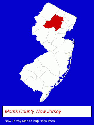
The New Jersey counties map at upper right shows Morris County, highlighted in red. Use the menu below to display interactive maps of Morristown, either in a frame on this page or in full-screen mode.
Use the menu below to display categorized Morristown directories.
| Morristown Products and Services Directory | ||
|---|---|---|
| Attorneys | Building Materials | Business Services |
| Clinics | Financial Services | Home Improvement |
| Physicians | Restaurants | Schools |
| Steak Restaurants | ||
Selected Morristown, New Jersey Listings
These randomly selected Morristown listings provide some insight into the town's cultural environment and economic climate.- Urology Physicians & Surgeons
- Financial Planning Consultants & Services
- Personal Financial Services
- Investment Services
- Investment Advisory Services
- Colleges & Universities
- Vocational Education
- Aviation Schools
- Business Brokers
- Business Consultants & Advisors
- Management Consultants
- Business Management Services
- Aviation Consultants
- Loan & Financing Services
- Chiropractors
- Ophthalmology Physicians & Surgeons
- Neurology Physicians & Surgeons
- Interior Decorators & Designers
- Food Products Wholesale & Manufacturers
- Canners & Food Processors
- Condiments & Sauces Wholesale & Manufacturers
- Condiments & Sauces Retail
- Food Processing
- Internet Products & Services
- Web Site Design
- Commercial & Graphic Artists
- Colleges & Universities
- Race Car Parts, Equipment & Supplies Retail
- Thai Restaurants
- Grocery Stores & Supermarkets
- Fruits & Vegetables Retail
- Farms & Ranches
Nearby New Jersey Cities and Towns *
- Denville (3) - Denville, New Jersey information and maps.
- Florham Park (2) - Florham Park, New Jersey information and maps.
- Madison (2) - Madison, New Jersey information and maps.
- Morris Plains (1) - Morris Plains, New Jersey information and maps.
- Parsippany (6) - Parsippany, New Jersey demographics and maps.
* Parenthesized numbers indicate economic activity levels.
Copyright © 2011-2026 RegionalDirectory.us. All rights reserved.