Jersey City, New Jersey Map and Directory
Regional Directory > States Menu > New Jersey
 According to the United States Census Bureau, Jersey City is a City that is located in Hudson County, New Jersey at 40.73 degrees North and 74.08 degrees West.
The city's time zone is America/New York, and the city's primary telephone area code is 551.
The land area of Jersey City is about 14.79 square miles, whereas the water area of the city is about 6.34 square miles.
Hudson County's land area is about 46 square miles, so the city occupies about 32.2 percent of the county's total land area.
According to the United States Census Bureau, Jersey City is a City that is located in Hudson County, New Jersey at 40.73 degrees North and 74.08 degrees West.
The city's time zone is America/New York, and the city's primary telephone area code is 551.
The land area of Jersey City is about 14.79 square miles, whereas the water area of the city is about 6.34 square miles.
Hudson County's land area is about 46 square miles, so the city occupies about 32.2 percent of the county's total land area.
The Census Bureau estimates that Jersey City had about 262,075 residents in 2019, which is approximately 17,720 people per square mile of land area.
According to recent American Community Survey data, the median household income in Jersey City was about $70,752 per year.
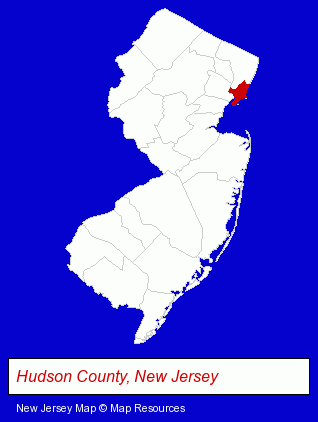
The New Jersey counties map at upper right shows Hudson County, highlighted in red. Use the menu below to display interactive maps of Jersey City, either in a frame on this page or in full-screen mode.
Use the menu below to display categorized Jersey City directories.
| Jersey City Products and Services Directory | ||
|---|---|---|
| Attorneys | Florists | Information Technology |
| Restaurants | Schools | |
Selected Jersey City, New Jersey Listings
These randomly selected Jersey City listings provide some insight into the city's cultural environment and economic climate.- T-Shirts Retail
- Corporate Business Attorneys
- Real Estate Attorneys
- Insurance Law Attorneys
- Veterinarians
- Textiles Wholesale & Manufacturers
- Signs Wholesale & Manufacturers
- Elementary & Secondary Education
- Private Schools
- High Schools
- Religious Education Schools
- Corporate Business Attorneys
- Arbitration & Mediation Services
- Arbitration & Mediation Services Attorneys
- Appeals Attorneys
- Cultural Attractions, Events & Facilities
- Tourist Information & Attractions
- Museums
- Software Design & Development
- Drug Stores & Pharmacies
- Pharmacists
- Auto Body Repair & Painting
- Trucking Companies
- Moving & Storage Commercial & Industrial
- Office Movers & Relocators
Nearby New Jersey Cities and Towns *
- Bayonne (1) - Bayonne, New Jersey information and maps.
- Hoboken (5) - Hoboken, New Jersey demographics and maps.
- Lyndhurst (3) - Lyndhurst, New Jersey information and maps.
- Newark (11) - Newark, New Jersey demographics and directory.
- North Bergen (1) - North Bergen, New Jersey information and maps.
Large and Mid-size Cities in Nearby States
- New York, New York (224) - New York, NY products & services directory.
- Yonkers, New York (14) - Yonkers, NY demographics and directory.
* Parenthesized numbers indicate economic activity levels.
Copyright © 2011-2026 RegionalDirectory.us. All rights reserved.