Pennsauken, New Jersey Map and Directory
Regional Directory > States Menu > New Jersey
 According to the United States Census Bureau, Pennsauken is a Township that is located in Camden County, New Jersey at 39.97 degrees North and 75.06 degrees West.
The township's time zone is America/New York, and the township's primary telephone area code is 856.
The land area of Pennsauken is about 10.44 square miles, whereas the water area of the township is about 1.65 square miles.
Camden County's land area is about 221 square miles, so the township occupies about 4.7 percent of the county's total land area.
According to the United States Census Bureau, Pennsauken is a Township that is located in Camden County, New Jersey at 39.97 degrees North and 75.06 degrees West.
The township's time zone is America/New York, and the township's primary telephone area code is 856.
The land area of Pennsauken is about 10.44 square miles, whereas the water area of the township is about 1.65 square miles.
Camden County's land area is about 221 square miles, so the township occupies about 4.7 percent of the county's total land area.
The Census Bureau estimates that Pennsauken had about 35,660 residents in 2019, which is approximately 3,416 people per square mile of land area.
According to recent American Community Survey data, the median household income in Pennsauken was about $67,300 per year.
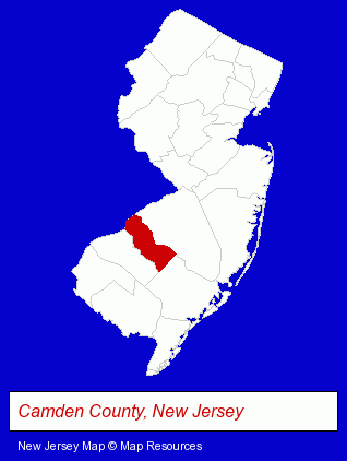
The New Jersey counties map at upper right shows Camden County, highlighted in red. Use the menu below to display interactive maps of Pennsauken, either in a frame on this page or in full-screen mode.
Use the menu below to display categorized Pennsauken directories.
| Pennsauken Products and Services Directory | ||
|---|---|---|
| Building Materials | Home Improvement | Metals |
Selected Pennsauken, New Jersey Listings
These representative Pennsauken listings provide some insight into the township's cultural environment and economic climate.- Printing & Publishing
- Printing Services
- Commercial Printing
- Computer Printers
- Computer Supplies, Parts & Accessories
- Schools
- Building & Home Construction
- Heating Contractors
- Boiler Cleaning & Repair
- Computer & Equipment Dealers
- Computers & Equipment Wholesale & Manufacturers
- Business Computer Dealers
- Cabinet Dealers
- Sheet Metal Contractors
- Building & Home Construction
- Special Trades Contractors
- Electric Contractors
- Electric Contractors Residential
- Food Products Wholesale & Manufacturers
- Ice Cream & Frozen Desserts Wholesale & Manufacturers
- Ice Cream Cones Wholesale & Manufacturers
- Libraries
- Resume Services
Nearby New Jersey Cities and Towns *
- Blackwood (2) - Blackwood, New Jersey information and maps.
- Cherry Hill (12) - Cherry Hill, New Jersey demographics and directory.
- Marlton (2) - Marlton, New Jersey information and maps.
- Moorestown (5) - Moorestown, New Jersey demographics and maps.
- Mount Laurel (2) - Mount Laurel, New Jersey information and maps.
Large and Mid-size Cities in Nearby States
- Philadelphia, Pennsylvania (86) - Philadelphia, PA products & services directory.
* Parenthesized numbers indicate economic activity levels.
Copyright © 2011-2026 RegionalDirectory.us. All rights reserved.