Clovis, New Mexico Map and Directory
Regional Directory > States Menu > New Mexico
 According to the United States Census Bureau, Clovis is a City that is located in Curry County, New Mexico at 34.40 degrees North and 103.21 degrees West.
The city's time zone is America/Denver, and the city's primary telephone area code is 575.
The land area of Clovis is about 23.61 square miles, whereas the water area of the city is about 0.17 square miles.
Curry County's land area is about 1,405 square miles, so the city occupies about 1.7 percent of the county's total land area.
According to the United States Census Bureau, Clovis is a City that is located in Curry County, New Mexico at 34.40 degrees North and 103.21 degrees West.
The city's time zone is America/Denver, and the city's primary telephone area code is 575.
The land area of Clovis is about 23.61 square miles, whereas the water area of the city is about 0.17 square miles.
Curry County's land area is about 1,405 square miles, so the city occupies about 1.7 percent of the county's total land area.
The Census Bureau estimates that Clovis had about 38,319 residents in 2019, which is approximately 1,623 people per square mile of land area.
According to recent American Community Survey data, the median household income in Clovis was about $43,111 per year.
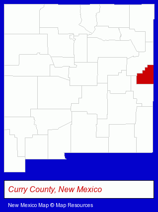
The New Mexico counties map at upper right shows Curry County, highlighted in red. Use the menu below to display interactive maps of Clovis, either in a frame on this page or in full-screen mode.
Use the menu below to display categorized Clovis directories.
| Clovis Directory Page: | Banks |
|---|
Selected Clovis, New Mexico Listings
These Clovis listings provide some insight into the city's cultural environment and economic climate. All Pets Animal Hospital- Clinics & Medical Centers
- Animal Hospitals
- Animal Health
- Pet Care Services
- Pet Grooming & Boarding
- Credit Unions
- Libraries
- Information Technology Services
- Computer Consultants
- Computer Networks
- Computer Systems Consultants & Designers
- Recording Studios
- Music & Recording Industry
- Audio Production & Recording
- Sound & Video Recording Services Commercial & Industrial
- Auctions
- Auctioneers & Auction Houses
Nearby New Mexico Cities and Towns *
- Albuquerque (88) - Albuquerque, New Mexico products & services directory.
- Las Cruces (12) - Las Cruces, New Mexico demographics and directory.
- Roswell (1) - Roswell, New Mexico information and maps.
- Ruidoso (2) - Ruidoso, New Mexico information and maps.
- Santa Fe (33) - Santa Fe, New Mexico products & services directory.
- Taos (6) - Taos, New Mexico demographics and maps.
* Parenthesized numbers indicate economic activity levels.
Copyright © 2011-2026 RegionalDirectory.us. All rights reserved.