Roswell, New Mexico Map and Directory
Regional Directory > States Menu > New Mexico
 According to the United States Census Bureau, Roswell is a City that is located in Chaves County, New Mexico at 33.39 degrees North and 104.52 degrees West.
The city's time zone is America/Denver, and the city's primary telephone area code is 575.
The land area of Roswell is about 29.86 square miles, whereas the water area of the city is about 0.06 square miles.
Chaves County's land area is about 6,065 square miles, so the city occupies about 0.5 percent of the county's total land area.
According to the United States Census Bureau, Roswell is a City that is located in Chaves County, New Mexico at 33.39 degrees North and 104.52 degrees West.
The city's time zone is America/Denver, and the city's primary telephone area code is 575.
The land area of Roswell is about 29.86 square miles, whereas the water area of the city is about 0.06 square miles.
Chaves County's land area is about 6,065 square miles, so the city occupies about 0.5 percent of the county's total land area.
The Census Bureau estimates that Roswell had about 47,551 residents in 2019, which is approximately 1,592 people per square mile of land area.
According to recent American Community Survey data, the median household income in Roswell was about $43,372 per year.
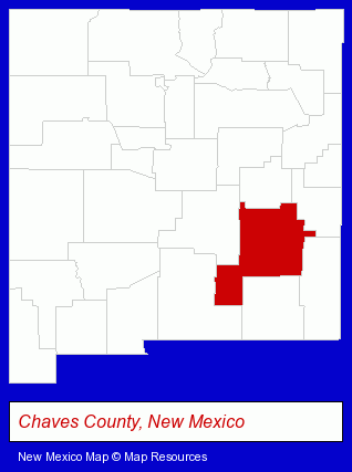
The New Mexico counties map at upper right shows Chaves County, highlighted in red. Use the menu below to display interactive maps of Roswell, either in a frame on this page or in full-screen mode.
Use the menu below to display categorized Roswell directories.
| Roswell Directory Page: | Attorneys |
|---|
Selected Roswell, New Mexico Listings
These Roswell listings provide some insight into the city's cultural environment and economic climate.- Business Services
- Computer Software
- Computer & Equipment Dealers
- Computers & Equipment Repair & Maintenance
- Consumer Electronics Stores
- Libraries
- Auto Service & Repair
- Oil & Gas Companies
- Oil & Gas Exploration & Development
- Oil Operators
- Land Surveyors
- Surveyors
- Surveying Services
- Land Surveyors Commercial
- Credit Unions
- Schools
- Public Schools
- Agricultural Equipment & Supplies Retail
- Agricultural Producers & Products
- Homes & Residential Real Estate
- General Real Estate
- Real Estate Commercial & Industrial
- Real Estate Investments
- Libraries
Nearby New Mexico Cities and Towns *
- Albuquerque (88) - Albuquerque, New Mexico products & services directory.
- Clovis (1) - Clovis, New Mexico information and maps.
- Las Cruces (12) - Las Cruces, New Mexico demographics and directory.
- Ruidoso (2) - Ruidoso, New Mexico information and maps.
- Santa Fe (33) - Santa Fe, New Mexico products & services directory.
- Taos (6) - Taos, New Mexico demographics and maps.
* Parenthesized numbers indicate economic activity levels.
Copyright © 2011-2026 RegionalDirectory.us. All rights reserved.