Mahopac, New York Map and Directory
Regional Directory > States Menu > New York
 According to the United States Census Bureau, Mahopac is a Census-designated Place that is located in Putnam County, New York at 41.37 degrees North and 73.73 degrees West.
The place's time zone is America/New York, and the place's primary telephone area code is 845.
The land area of Mahopac is about 5.28 square miles, whereas the water area of the place is about 1.17 square miles.
Putnam County's land area is about 230 square miles, so the place occupies about 2.3 percent of the county's total land area.
According to the United States Census Bureau, Mahopac is a Census-designated Place that is located in Putnam County, New York at 41.37 degrees North and 73.73 degrees West.
The place's time zone is America/New York, and the place's primary telephone area code is 845.
The land area of Mahopac is about 5.28 square miles, whereas the water area of the place is about 1.17 square miles.
Putnam County's land area is about 230 square miles, so the place occupies about 2.3 percent of the county's total land area.
The Census Bureau estimates that Mahopac had about 8,203 residents in 2019, which is approximately 1,554 people per square mile of land area.
According to recent American Community Survey data, the median household income in Mahopac was about $89,175 per year.
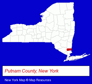
The New York counties map at upper right shows Putnam County, highlighted in red. Use the menu below to display interactive maps of Mahopac, either in a frame on this page or in full-screen mode.
Use the menu below to display categorized Mahopac directories.
| Mahopac Products and Services Directory | |
|---|---|
| Building Materials | Home Improvement |
Selected Mahopac, New York Listings
These representative Mahopac listings provide some insight into the place's cultural environment and economic climate.- Jewelers
- Antiques
- Jewelry Repair
- Clinics & Medical Centers
- Veterinarians
- Animal Hospitals
- Animal Health
- Drug Stores & Pharmacies
- Pharmaceutical Products Wholesale & Manufacturers
- Metals
- Metal Fabricators
- Sheet Metal Equipment & Supplies Wholesale & Manufacturers
- Pediatrics Dentists
- Soccer
- Cultural Attractions, Events & Facilities
- Libraries
- Schools
- Gymnastics Instruction
- Optometrists
- Optical Goods Retail
- Auto Body Repair & Painting
- Educational Services
- Educational Consultants
- Test Preparation & Tutoring Services
Nearby New York Cities and Towns *
- Bedford Hills (4) - Bedford Hills, New York information and maps.
- Fishkill (3) - Fishkill, New York information and maps.
- Poughkeepsie (17) - Poughkeepsie, New York solutions directory and maps.
- White Plains (25) - White Plains, New York solutions directory and maps.
Large and Mid-size Cities in Nearby States
- Ridgefield, Connecticut (6) - Ridgefield, CT information and maps.
- Danbury, Connecticut (17) - Danbury, CT demographics and directory.
* Parenthesized numbers indicate economic activity levels.
Copyright © 2011-2026 RegionalDirectory.us. All rights reserved.