White Plains, New York Map and Directory
Regional Directory > States Menu > New York
 According to the United States Census Bureau, White Plains is a City that is located in Westchester County, New York at 41.03 degrees North and 73.76 degrees West.
The city's time zone is America/New York, and the city's primary telephone area code is 914.
The land area of White Plains is about 9.77 square miles, whereas the water area of the city is about 0.12 square miles.
Westchester County's land area is about 431 square miles, so the city occupies about 2.3 percent of the county's total land area.
According to the United States Census Bureau, White Plains is a City that is located in Westchester County, New York at 41.03 degrees North and 73.76 degrees West.
The city's time zone is America/New York, and the city's primary telephone area code is 914.
The land area of White Plains is about 9.77 square miles, whereas the water area of the city is about 0.12 square miles.
Westchester County's land area is about 431 square miles, so the city occupies about 2.3 percent of the county's total land area.
The Census Bureau estimates that White Plains had about 58,109 residents in 2019, which is approximately 5,948 people per square mile of land area.
According to recent American Community Survey data, the median household income in White Plains was about $90,427 per year. This White Plains Real Estate directory lists real estate solution providers in White Plains, New York.
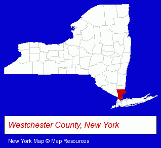
The New York counties map at upper right shows Westchester County, highlighted in red. Use the menu below to display interactive maps of White Plains, either in a frame on this page or in full-screen mode.
Use the menu below to display categorized White Plains directories.
| White Plains Products and Services Directory | ||
|---|---|---|
| Accountants | Attorneys | Auto Dealers |
| Auto Service | Building Contractors | Business Services |
| Chiropractors | Financial Services | Insurance |
| Physicians | Restaurants | Visual Arts |
Selected White Plains, New York Listings
These randomly selected White Plains listings provide some insight into the city's cultural environment and economic climate.- T-Shirts Retail
- Counseling Services
- Financial Counselors
- Web Site Design
- Web Site Developers
- Internet Marketing Services
- Criminal Law Attorneys
- Arbitration & Mediation Services Attorneys
- Appeals Attorneys
- Adoption Attorneys
- Administrative & Governmental Law Attorneys
- Kitchen Design & Remodeling Services
- Loan & Financing Services
- Publishers
- Book Publishers
- Coffee & Tea Shops
- Welding Services
- Corporate Business Attorneys
- Real Estate Attorneys
- Employment & Labor Law Attorneys
Nearby New York Cities and Towns *
- Mamaroneck (3) - Mamaroneck, New York information and maps.
- Mount Vernon (6) - Mount Vernon, New York demographics and maps.
- New Rochelle (8) - New Rochelle, New York demographics and maps.
- Nyack (3) - Nyack, New York information and maps.
- Scarsdale (9) - Scarsdale, New York demographics and directory.
- Tarrytown (4) - Tarrytown, New York information and maps.
- Yonkers (14) - Yonkers, New York demographics and directory.
Large and Mid-size Cities in Nearby States
- Greenwich, Connecticut (8) - Greenwich, CT demographics and maps.
* Parenthesized numbers indicate economic activity levels.
Copyright © 2011-2026 RegionalDirectory.us. All rights reserved.