Tarrytown, New York Map and Directory
Regional Directory > States Menu > New York
 According to the United States Census Bureau, Tarrytown is a Village that is located in Westchester County, New York at 41.08 degrees North and 73.86 degrees West.
The village's time zone is America/New York, and the village's primary telephone area code is 914.
The land area of Tarrytown is about 2.93 square miles, whereas the water area of the village is about 2.75 square miles.
Westchester County's land area is about 431 square miles, so the village occupies about 0.7 percent of the county's total land area.
According to the United States Census Bureau, Tarrytown is a Village that is located in Westchester County, New York at 41.08 degrees North and 73.86 degrees West.
The village's time zone is America/New York, and the village's primary telephone area code is 914.
The land area of Tarrytown is about 2.93 square miles, whereas the water area of the village is about 2.75 square miles.
Westchester County's land area is about 431 square miles, so the village occupies about 0.7 percent of the county's total land area.
The Census Bureau estimates that Tarrytown had about 11,370 residents in 2019, which is approximately 3,881 people per square mile of land area.
According to recent American Community Survey data, the median household income in Tarrytown was about $124,046 per year.
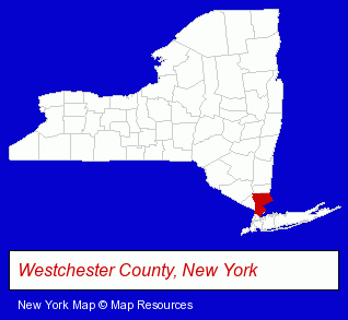
The New York counties map at upper right shows Westchester County, highlighted in red. Use the menu below to display interactive maps of Tarrytown, either in a frame on this page or in full-screen mode.
Use the menu below to display categorized Tarrytown directories.
| Tarrytown Products and Services Directory | ||
|---|---|---|
| Attorneys | Business Services | Financial Services |
| Information Technology | ||
Selected Tarrytown, New York Listings
These randomly selected Tarrytown listings provide some insight into the village's cultural environment and economic climate.- Pet Food & Supplies Retail
- Pet Shops
- Investment Services
- Investment Advisory Services
- Hotels
- Motels
- Convention & Meeting Facilities & Services
- Visual Arts
- Crafts & Craft Supplies Retail
- Crafts Instruction & Schools
- Yarn
- Sewing Schools
- Exporters
- International Business Services
- Export Management Consultants
- Chemicals Wholesale & Manufacturers
- Restaurants
- Greek Restaurants
- Cardiology Physicians & Surgeons
- Cardiology Pediatrics Physicians & Surgeons
- Legal Services
- Trial Attorneys
- Accountants
- Certified Public Accountants
- Computer Networks
- Computer Printers
- Computer Hardware & Supplies
- Computer Networking Installation
- Computer Network Hardware
- Social & Human Services
- Mental Health
- Counseling Services
- Marriage & Family Counseling
- Social Workers
- Business Management Services
- Financial Planning Consultants & Services
- Retirement Planning Consultants & Services
- Clinics & Medical Centers
- Rehabilitation Services
- Rehabilitation Centers
- Alcohol & Drug Abuse Information & Treatment
- Addiction Information & Treatment
- Lodging
- Hotels
- Bed & Breakfasts
- Conventions, Conferences & Trade Shows
- Convention & Meeting Facilities & Services
- Garden Centers
- Tree Services Commercial & Industrial
- Loan & Financing Services
- Hotels
- Motels
- Banquet Facilities
- Convention & Meeting Facilities & Services
- Wedding Receptions & Parties
Nearby New York Cities and Towns *
- Mount Vernon (6) - Mount Vernon, New York demographics and maps.
- New City (4) - New City, New York information and maps.
- New Rochelle (8) - New Rochelle, New York demographics and maps.
- Scarsdale (9) - Scarsdale, New York demographics and directory.
- White Plains (25) - White Plains, New York solutions directory and maps.
- Yonkers (14) - Yonkers, New York demographics and directory.
* Parenthesized numbers indicate economic activity levels.
Copyright © 2011-2026 RegionalDirectory.us. All rights reserved.