Alliance, Ohio Map and Directory
Regional Directory > States Menu > Ohio
 According to the United States Census Bureau, Alliance is a City that is located primarily in Stark County, Ohio at 40.91 degrees North and 81.12 degrees West.
The city's time zone is America/New York, and the city's primary telephone area code is 330.
The land area of Alliance is about 9.00 square miles, whereas the water area of the city is about 0.04 square miles.
According to the United States Census Bureau, Alliance is a City that is located primarily in Stark County, Ohio at 40.91 degrees North and 81.12 degrees West.
The city's time zone is America/New York, and the city's primary telephone area code is 330.
The land area of Alliance is about 9.00 square miles, whereas the water area of the city is about 0.04 square miles.
The Census Bureau estimates that Alliance had about 21,446 residents in 2019, which is approximately 2,383 people per square mile of land area.
According to recent American Community Survey data, the median household income in Alliance was about $35,718 per year.
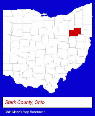
The Ohio counties map at upper right shows Stark County, highlighted in red. Use the menu below to display interactive maps of Alliance, either in a frame on this page or in full-screen mode.
Use the menu below to display categorized Alliance directories.
| Alliance Products and Services Directory | ||
|---|---|---|
| Dentists | Metals | Physicians |
Selected Alliance, Ohio Listings
These representative Alliance listings in 44601 provide a window into the city's cultural environment and economic climate. Adoption Home Study Service of OH- Social & Human Services
- Adoption Agencies & Services
- Civic Clubs & Organizations
- Sports & Recreation Clubs & Organizations
- Private Golf Courses
- Private Golf Clubs
- Country Clubs
- Pet Care Services
- Animal Shelters
- Truck Dealers
- Truck Equipment, Parts & Accessories Retail
- Used Trucks
- Truck Rental
- Industrial Equipment Rebuilding, Service & Repair
- Electric & Electronic Equipment & Supplies
- Electric Motor Dealers
- Candy & Confectionery Retail
- Office Supplies Retail
- Building & Home Construction
- Home Builders & Developers
- Florists
- Nurseries
- Sun Rooms, Greenhouses, Solariums & Atriums Builders
- Moving & Storage
- Osteopathic Physicians & Surgeons
- Cardiology Physicians & Surgeons
- Plastic Molders
- Plastic Molders
- Plastic Molds Manufacturers
- Metal Products
- Metal Products Wholesale & Manufacturers
- Steel Distributors & Service Centers
Nearby Ohio Cities and Towns *
- Akron (38) - Akron, Ohio products & services directory.
- Canton (21) - Canton, Ohio solutions directory and maps.
- Kent (5) - Kent, Ohio demographics and maps.
- North Canton (10) - North Canton, Ohio demographics and directory.
* Parenthesized numbers indicate economic activity levels.
Copyright © 2011-2026 RegionalDirectory.us. All rights reserved.