Kent, Ohio Map and Directory
Regional Directory > States Menu > Ohio
 According to the United States Census Bureau, Kent is a City that is located in Portage County, Ohio at 41.15 degrees North and 81.36 degrees West.
The city's time zone is America/New York, and the city's primary telephone area code is 330.
The land area of Kent is about 9.18 square miles, whereas the water area of the city is about 0.11 square miles.
Portage County's land area is about 487 square miles, so the city occupies about 1.9 percent of the county's total land area.
According to the United States Census Bureau, Kent is a City that is located in Portage County, Ohio at 41.15 degrees North and 81.36 degrees West.
The city's time zone is America/New York, and the city's primary telephone area code is 330.
The land area of Kent is about 9.18 square miles, whereas the water area of the city is about 0.11 square miles.
Portage County's land area is about 487 square miles, so the city occupies about 1.9 percent of the county's total land area.
The Census Bureau estimates that Kent had about 29,646 residents in 2019, which is approximately 3,229 people per square mile of land area.
According to recent American Community Survey data, the median household income in Kent was about $32,993 per year.
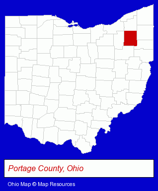
The Ohio counties map at upper right shows Portage County, highlighted in red. Use the menu below to display interactive maps of Kent, either in a frame on this page or in full-screen mode.
Use the menu below to display categorized Kent directories.
| Kent Products and Services Directory | ||
|---|---|---|
| Auto Engine Services | Auto Service | Building Materials |
| Home Improvement | Metals | |
Selected Kent, Ohio Listings
These randomly selected Kent listings provide some insight into the city's cultural environment and economic climate.- Family & General Practice Physicians & Surgeons
- Construction Machinery & Equipment Wholesale & Manufacturers
- Cabinet Dealers
- Cabinets & Cabinet Makers Residential
- Cabinets Wholesale & Manufacturers
- Industrial Equipment & Supplies Wholesale & Manufacturers
- Industrial Equipment Parts & Accessories Wholesale & Manufacturers
- Steak Restaurants
- Caterers
- Take Out
- Delicatessens
- Party Equipment & Supplies Sales & Rental
- Plastic & Plastic Products Wholesale & Manufacturers
- Disposable Products Retail
- Vacuum & Pressure Forming Plastic Manufacturers
- Sign Dealers
- Signs Wholesale & Manufacturers
- Commercial Signs
- Housewares Wholesale & Manufacturers
- Adoption Attorneys
- Travel Agents
- Travel Industry
- Caterers
- Bar & Grill Restaurants
- Italian Restaurants
- Bars & Pubs
- Industrial Equipment & Supplies Wholesale & Manufacturers
- Industrial Equipment Parts & Accessories Wholesale & Manufacturers
- Plastic Molders
- Plastic Molds Manufacturers
- Outdoor Sports & Recreation
- Public Golf Courses
- Golf
- Golf Courses
- Industrial Equipment & Supplies Dealers
- Industrial Equipment & Supplies Wholesale & Manufacturers
- Machine Tool Dealers
Nearby Ohio Cities and Towns *
- Akron (38) - Akron, Ohio products & services directory.
- Cuyahoga Falls (4) - Cuyahoga Falls, Ohio information and maps.
- Hudson (2) - Hudson, Ohio information and maps.
- Ravenna (1) - Ravenna, Ohio information and maps.
- Stow (2) - Stow, Ohio information and maps.
- Tallmadge (1) - Tallmadge, Ohio information and maps.
- Twinsburg (4) - Twinsburg, Ohio information and maps.
* Parenthesized numbers indicate economic activity levels.
Copyright © 2011-2026 RegionalDirectory.us. All rights reserved.