Amherst, Ohio Map and Directory
Regional Directory > States Menu > Ohio
 According to the United States Census Bureau, Amherst is a City that is located in Lorain County, Ohio at 41.40 degrees North and 82.22 degrees West.
The city's time zone is America/New York, and the city's primary telephone area code is 440.
The land area of Amherst is about 7.06 square miles, whereas the water area of the city is about 0.06 square miles.
Lorain County's land area is about 491 square miles, so the city occupies about 1.4 percent of the county's total land area.
According to the United States Census Bureau, Amherst is a City that is located in Lorain County, Ohio at 41.40 degrees North and 82.22 degrees West.
The city's time zone is America/New York, and the city's primary telephone area code is 440.
The land area of Amherst is about 7.06 square miles, whereas the water area of the city is about 0.06 square miles.
Lorain County's land area is about 491 square miles, so the city occupies about 1.4 percent of the county's total land area.
The Census Bureau estimates that Amherst had about 12,219 residents in 2019, which is approximately 1,731 people per square mile of land area.
According to recent American Community Survey data, the median household income in Amherst was about $71,775 per year.
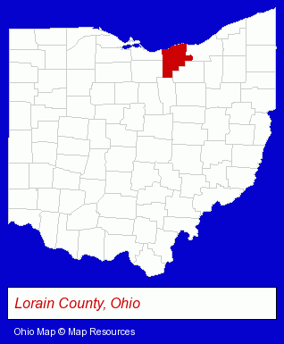
The Ohio counties map at upper right shows Lorain County, highlighted in red. Use the menu below to display interactive maps of Amherst, either in a frame on this page or in full-screen mode.
Use the menu below to display categorized Amherst directories.
| Amherst Directory Page: | Visual Arts |
|---|
Selected Amherst, Ohio Listings
These Amherst listings provide some insight into the city's cultural environment and economic climate. A M E Metals Inc- Metals
- Metal Products
- Metal Products Dealers
- Metal Dealers
- Metals
- Metal Products
- Metal Products Dealers
- Metal Dealers
- Cultural Attractions, Events & Facilities
- Tourist Information & Attractions
- Museums
- Sporting Goods Dealers
- Restaurants
- Pizza Restaurants
- Financial Services
- Financial Planning Consultants & Services
- Personal Financial Services
Nearby Ohio Cities and Towns *
- Avon (2) - Avon, Ohio information and maps.
- Berea (2) - Berea, Ohio information and maps.
- Elyria (6) - Elyria, Ohio demographics and maps.
- Lorain (2) - Lorain, Ohio information and maps.
- Rocky River (3) - Rocky River, Ohio information and maps.
- Strongsville (5) - Strongsville, Ohio demographics and maps.
- Westlake (7) - Westlake, Ohio demographics and maps.
* Parenthesized numbers indicate economic activity levels.
Copyright © 2011-2026 RegionalDirectory.us. All rights reserved.