Elyria, Ohio Map and Directory
Regional Directory > States Menu > Ohio
 According to the United States Census Bureau, Elyria is a City that is located in Lorain County, Ohio at 41.37 degrees North and 82.11 degrees West.
The city's time zone is America/New York, and the city's primary telephone area code is 440.
The land area of Elyria is about 20.57 square miles, whereas the water area of the city is about 0.27 square miles.
Lorain County's land area is about 491 square miles, so the city occupies about 4.2 percent of the county's total land area.
According to the United States Census Bureau, Elyria is a City that is located in Lorain County, Ohio at 41.37 degrees North and 82.11 degrees West.
The city's time zone is America/New York, and the city's primary telephone area code is 440.
The land area of Elyria is about 20.57 square miles, whereas the water area of the city is about 0.27 square miles.
Lorain County's land area is about 491 square miles, so the city occupies about 4.2 percent of the county's total land area.
The Census Bureau estimates that Elyria had about 53,757 residents in 2019, which is approximately 2,613 people per square mile of land area.
According to recent American Community Survey data, the median household income in Elyria was about $44,324 per year.
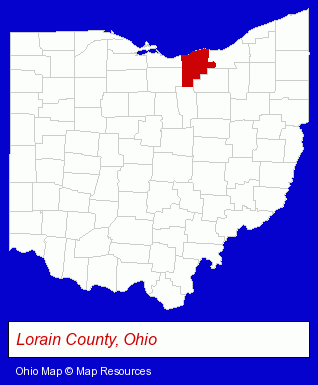
The Ohio counties map at upper right shows Lorain County, highlighted in red. Use the menu below to display interactive maps of Elyria, either in a frame on this page or in full-screen mode.
Use the menu below to display categorized Elyria directories.
| Elyria Products and Services Directory | ||
|---|---|---|
| Attorneys | Auto Engine Services | Auto Service |
| Building Materials | Home Improvement | Metals |
Selected Elyria, Ohio Listings
These randomly selected Elyria listings provide some insight into the city's cultural environment and economic climate.- Auto Parts Retail
- Auto Accessories Retail
- Public Accountants
- Certified Public Accountants
- Industrial Equipment & Supplies Wholesale & Manufacturers
- Industrial Equipment Parts & Accessories Wholesale & Manufacturers
- Toys Wholesale & Manufacturers
- Hobby & Model Supplies Wholesale & Manufacturers
- Auto Body Repair & Painting
- Auto Cleaning & Detailing
- Auto Washing & Polishing
- Metal Products
- Metal Products Wholesale & Manufacturers
- Steel Fabrication
- Pet Care Services
- Animal Shelters
- Public Accountants
- Certified Public Accountants
- Industrial Equipment & Supplies Wholesale & Manufacturers
- Industrial Equipment Parts & Accessories Wholesale & Manufacturers
- Sporting Goods Dealers
- Elementary & Secondary Education
- Elementary Schools
- Elementary & Secondary Education
- Elementary Schools
- Building & Home Construction
- Special Trades Contractors
- Electric Contractors
- Electric Contractors Residential
- Lighting Retail
- Candy & Confectionery Retail
- Lubricating Oils Retail
Nearby Ohio Cities and Towns *
- Amherst (1) - Amherst, Ohio information and maps.
- Avon (2) - Avon, Ohio information and maps.
- Avon Lake (1) - Avon Lake, Ohio information and maps.
- Lorain (2) - Lorain, Ohio information and maps.
- North Olmsted (1) - North Olmsted, Ohio information and maps.
- North Ridgeville (1) - North Ridgeville, Ohio information and maps.
- Westlake (7) - Westlake, Ohio demographics and maps.
* Parenthesized numbers indicate economic activity levels.
Copyright © 2011-2026 RegionalDirectory.us. All rights reserved.