Batavia, Ohio Map and Directory
Regional Directory > States Menu > Ohio
 According to the United States Census Bureau, Batavia is a Village that is located in Clermont County, Ohio at 39.08 degrees North and 84.18 degrees West.
The village's time zone is America/New York, and the village's primary telephone area code is 513.
The land area of Batavia is about 2.57 square miles, whereas the water area of the village is about 0.06 square miles.
Clermont County's land area is about 452 square miles, so the village occupies about 0.6 percent of the county's total land area.
According to the United States Census Bureau, Batavia is a Village that is located in Clermont County, Ohio at 39.08 degrees North and 84.18 degrees West.
The village's time zone is America/New York, and the village's primary telephone area code is 513.
The land area of Batavia is about 2.57 square miles, whereas the water area of the village is about 0.06 square miles.
Clermont County's land area is about 452 square miles, so the village occupies about 0.6 percent of the county's total land area.
The Census Bureau estimates that Batavia had about 1,645 residents in 2014, which is approximately 640 people per square mile of land area.
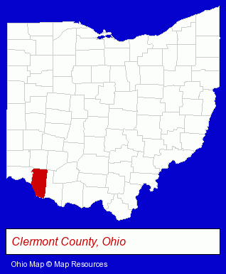
The Ohio counties map at upper right shows Clermont County, highlighted in red. Use the menu below to display interactive maps of Batavia, either in a frame on this page or in full-screen mode.
Use the menu below to display categorized Batavia directories.
| Batavia Products and Services Directory | |
|---|---|
| Building Materials | Home Improvement |
Selected Batavia, Ohio Listings
These representative Batavia listings provide some insight into the village's cultural environment and economic climate.- Charitable & Nonprofit Organizations
- Pet Care Services
- Pet Food & Supplies Retail
- Pet Shops
- Animal Shelters
- Agricultural Equipment & Supplies Retail
- Farm Equipment & Supplies Dealers
- Pet Food & Supplies Retail
- Laboratories
- Testing Laboratories
- Chemicals Dealers
- Analytical Testing Laboratories
- Clinics & Medical Centers
- Cultural Attractions, Events & Facilities
- Tourist Information & Attractions
- Libraries
- Special Interest Libraries
- Government Offices
- County Government
- Local Government
- Law Enforcement
- Laboratories
- Testing Laboratories
- Chemicals Wholesale & Manufacturers
- Analytical Testing Laboratories
- Accountants
- Public Accountants
- Certified Public Accountants
- Florists
- Plastic & Plastic Products Wholesale & Manufacturers
- Food Products Wholesale & Manufacturers
- Outdoor Sports & Recreation
- Public Golf Courses
- Golf
- Golf Courses
- Plastic & Plastic Products Wholesale & Manufacturers
- Airports
- Food Products Wholesale & Manufacturers
- Restaurant Equipment & Services
- Restaurant Equipment & Supplies Retail
- Restaurant Equipment & Supplies Wholesale & Manufacturers
- Auctions
- Auctioneers & Auction Houses
Nearby Ohio Cities and Towns *
- Cincinnati (109) - Cincinnati, Ohio products & services directory.
- Loveland (3) - Loveland, Ohio information and maps.
- West Chester (7) - West Chester, Ohio demographics and maps.
* Parenthesized numbers indicate economic activity levels.
Copyright © 2011-2026 RegionalDirectory.us. All rights reserved.