Cincinnati, Ohio Map and Directory
Regional Directory > States Menu > Ohio
 According to the United States Census Bureau, Cincinnati is a City that is located in Hamilton County, Ohio at 39.16 degrees North and 84.46 degrees West.
The city's time zone is America/New York, and the city's primary telephone area code is 513.
The land area of Cincinnati is about 77.94 square miles, whereas the water area of the city is about 1.60 square miles.
Hamilton County's land area is about 406 square miles, so the city occupies about 19.2 percent of the county's total land area.
According to the United States Census Bureau, Cincinnati is a City that is located in Hamilton County, Ohio at 39.16 degrees North and 84.46 degrees West.
The city's time zone is America/New York, and the city's primary telephone area code is 513.
The land area of Cincinnati is about 77.94 square miles, whereas the water area of the city is about 1.60 square miles.
Hamilton County's land area is about 406 square miles, so the city occupies about 19.2 percent of the county's total land area.
The Census Bureau estimates that Cincinnati had about 303,940 residents in 2019, which is approximately 3,900 people per square mile of land area.
According to recent American Community Survey data, the median household income in Cincinnati was about $40,640 per year. This Cincinnati Real Estate directory lists real estate solution providers in Cincinnati, Ohio.
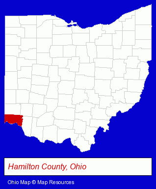
The Ohio counties map at upper right shows Hamilton County, highlighted in red. Use the menu below to display interactive maps of Cincinnati, either in a frame on this page or in full-screen mode.
Use the menu below to display categorized Cincinnati directories.
Selected Cincinnati, Ohio Listings
These randomly selected Cincinnati listings provide some insight into the city's cultural environment and economic climate.- Office Supplies Retail
- Advertising
- Advertising & Promotional Product Dealers
- Advertising Specialties Wholesale & Manufacturers
- Corporate Advertising Specialties & Promotions
- Periodontics Dentists
- Laboratories
- Medical Laboratories
- Research & Development Laboratories
- Biological Laboratories
- Musical Instruments Retail
- Musical Instrument Rental & Leasing
- Chemicals Wholesale & Manufacturers
- Specialty & Gourmet Foods Retail
- Gourmet Foods Retail
- Outdoor Sports & Recreation
- Bicycle Dealers
- Bicycle Repair & Maintenance
- Bicycle Rental
- Bicycle Parts & Supplies Dealers
- Metal Polishing, Buffing & Plating
- Building Materials & Supplies Wholesale & Manufacturers
- Freight & Cargo Transport
- Freight Forwarding
- Hardware Wholesale & Manufacturers
- Baked Goods Wholesale & Manufacturers
- Pet Care Services
- Pet Grooming & Boarding
- Pet Sitting & Day Care
- Dog & Cat Grooming & Boarding
- Cosmetic Dentists
- Energy & Environment
- Solar Energy Systems & Services Retail
- Building & Home Construction
- Metals
- Mechanical Contractors
- Ventilating Contractors
Nearby Ohio Cities and Towns *
- Batavia (2) - Batavia, Ohio information and maps.
- Loveland (3) - Loveland, Ohio information and maps.
- West Chester (7) - West Chester, Ohio demographics and maps.
* Parenthesized numbers indicate economic activity levels.
Copyright © 2011-2026 RegionalDirectory.us. All rights reserved.