Cuyahoga Falls, Ohio Map and Directory
Regional Directory > States Menu > Ohio
 According to the United States Census Bureau, Cuyahoga Falls is a City that is located in Summit County, Ohio at 41.13 degrees North and 81.48 degrees West.
The city's time zone is America/New York, and the city's primary telephone area code is 330.
The land area of Cuyahoga Falls is about 25.62 square miles, whereas the water area of the city is about 0.10 square miles.
Summit County's land area is about 413 square miles, so the city occupies about 6.2 percent of the county's total land area.
According to the United States Census Bureau, Cuyahoga Falls is a City that is located in Summit County, Ohio at 41.13 degrees North and 81.48 degrees West.
The city's time zone is America/New York, and the city's primary telephone area code is 330.
The land area of Cuyahoga Falls is about 25.62 square miles, whereas the water area of the city is about 0.10 square miles.
Summit County's land area is about 413 square miles, so the city occupies about 6.2 percent of the county's total land area.
The Census Bureau estimates that Cuyahoga Falls had about 49,106 residents in 2019, which is approximately 1,917 people per square mile of land area.
According to recent American Community Survey data, the median household income in Cuyahoga Falls was about $57,101 per year.
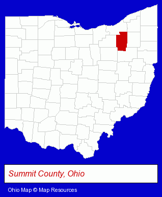
The Ohio counties map at upper right shows Summit County, highlighted in red. Use the menu below to display interactive maps of Cuyahoga Falls, either in a frame on this page or in full-screen mode.
Use the menu below to display categorized Cuyahoga Falls directories.
| Cuyahoga Falls Products and Services Directory | ||
|---|---|---|
| Business Services | Information Technology | Insurance |
| Schools | ||
Selected Cuyahoga Falls, Ohio Listings
These randomly selected Cuyahoga Falls listings provide some insight into the city's cultural environment and economic climate.- Computer Software
- Insurance Claims & Services
- Medical Billing Services
- Restaurant Equipment & Services
- Ice Cream & Frozen Yogurt Shops
- Restaurant Equipment & Supplies Retail
- Restaurant Equipment & Supplies Wholesale & Manufacturers
- Restaurant Equipment Service & Repair
- Dentists
- Orthodontics Dentists
- Musical Instruments Retail
- Musical Instrument Service & Repair
- Musical Instrument Rental & Leasing
- Libraries
- Computer Consultants
- Computer Systems Consultants & Designers
- Physicians & Surgeons
- Osteopathic Physicians & Surgeons
- Orthopedics Physicians & Surgeons
- Clothing & Accessories Retail
- Jewelers
- Jewelry Repair
- Watch Service & Repair
- Jewelry Brokers & Buyers
- Auto Body Repair & Painting
- Auto Customizing, Conversion & Restoration
- Custom Auto Painting
- Industrial Equipment & Supplies Dealers
- Industrial Equipment & Supplies Wholesale & Manufacturers
- Financial Services
- Personal Financial Services
- Investment Services
- Investment Advisory Services
- Stock & Bond Brokers
- Insurance Consultants & Advisors
- Moving & Storage
- Household Goods & Furniture Storage
- Household Goods Moving & Storage
- Mini & Self Storage
Nearby Ohio Cities and Towns *
- Akron (38) - Akron, Ohio products & services directory.
- Barberton (1) - Barberton, Ohio information and maps.
- Hudson (2) - Hudson, Ohio information and maps.
- Kent (5) - Kent, Ohio demographics and maps.
- Stow (2) - Stow, Ohio information and maps.
- Tallmadge (1) - Tallmadge, Ohio information and maps.
- Twinsburg (4) - Twinsburg, Ohio information and maps.
* Parenthesized numbers indicate economic activity levels.
Copyright © 2011-2026 RegionalDirectory.us. All rights reserved.