Lancaster, Ohio Map and Directory
Regional Directory > States Menu > Ohio
 According to the United States Census Bureau, Lancaster is a City that is located in Fairfield County, Ohio at 39.71 degrees North and 82.60 degrees West.
The city's time zone is America/New York, and the city's primary telephone area code is 740.
The land area of Lancaster is about 18.85 square miles, whereas the water area of the city is about 0.06 square miles.
Fairfield County's land area is about 504 square miles, so the city occupies about 3.7 percent of the county's total land area.
According to the United States Census Bureau, Lancaster is a City that is located in Fairfield County, Ohio at 39.71 degrees North and 82.60 degrees West.
The city's time zone is America/New York, and the city's primary telephone area code is 740.
The land area of Lancaster is about 18.85 square miles, whereas the water area of the city is about 0.06 square miles.
Fairfield County's land area is about 504 square miles, so the city occupies about 3.7 percent of the county's total land area.
The Census Bureau estimates that Lancaster had about 40,505 residents in 2019, which is approximately 2,149 people per square mile of land area.
According to recent American Community Survey data, the median household income in Lancaster was about $43,720 per year.
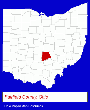
The Ohio counties map at upper right shows Fairfield County, highlighted in red. Use the menu below to display interactive maps of Lancaster, either in a frame on this page or in full-screen mode.
Use the menu below to display categorized Lancaster directories.
| Lancaster Products and Services Directory | ||
|---|---|---|
| Attorneys | Auto Service | Clinics |
| Information Technology | Insurance | Restaurants |
Selected Lancaster, Ohio Listings
These randomly selected Lancaster listings provide some insight into the city's cultural environment and economic climate.- Home Furnishings Stores
- Furniture Stores
- Gift Shops
- Musical Instruments Retail
- Musical Instrument Service & Repair
- Pianos & Organs Retail
- Piano Tuning, Repair & Refinishing
- Corporate Business Attorneys
- Family Law Attorneys
- Estate Planning & Administration Attorneys
- Employment & Labor Law Attorneys
- Home Furnishings Stores
- Furniture Stores
- Furniture Wholesale & Manufacturers
- Bedroom Furniture
- Mattresses Retail
- Schools
- Elementary & Secondary Education
- Elementary Schools
- Public Schools
- County Government
- Office Supplies Retail
- Gift Shops
- Stationery Retail
- Outdoor Sports & Recreation
- Lodging
- Camps
- Sports Camps
- Corporate Business Attorneys
- Personal Injury Attorneys
- Criminal Law Attorneys
- Estate Planning & Administration Attorneys
- Physicians & Surgeons
- Optometrists
- Osteopathic Physicians & Surgeons
- Ophthalmology Physicians & Surgeons
- Computer Consultants
- Computer Systems Consultants & Designers
- Cultural Attractions, Events & Facilities
- Tourist Information & Attractions
- Museums
- Pizza Restaurants
Nearby Ohio Cities and Towns *
- Circleville (1) - Circleville, Ohio information and maps.
- Newark (3) - Newark, Ohio information and maps.
- Pickerington (1) - Pickerington, Ohio information and maps.
- Reynoldsburg (1) - Reynoldsburg, Ohio information and maps.
* Parenthesized numbers indicate economic activity levels.
Copyright © 2011-2026 RegionalDirectory.us. All rights reserved.