Reynoldsburg, Ohio Map and Directory
Regional Directory > States Menu > Ohio
 According to the United States Census Bureau, Reynoldsburg is a City that is located primarily in Franklin County, Ohio at 39.96 degrees North and 82.79 degrees West.
The city's time zone is America/New York, and the city's primary telephone area code is 614.
The land area of Reynoldsburg is about 11.11 square miles, whereas the water area of the city is about 0.08 square miles.
According to the United States Census Bureau, Reynoldsburg is a City that is located primarily in Franklin County, Ohio at 39.96 degrees North and 82.79 degrees West.
The city's time zone is America/New York, and the city's primary telephone area code is 614.
The land area of Reynoldsburg is about 11.11 square miles, whereas the water area of the city is about 0.08 square miles.
The Census Bureau estimates that Reynoldsburg had about 38,327 residents in 2019, which is approximately 3,450 people per square mile of land area.
According to recent American Community Survey data, the median household income in Reynoldsburg was about $67,120 per year.
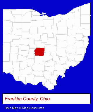
The Ohio counties map at upper right shows Franklin County, highlighted in red. Use the menu below to display interactive maps of Reynoldsburg, either in a frame on this page or in full-screen mode.
Use the menu below to display categorized Reynoldsburg directories.
| Reynoldsburg Directory Page: | Dentists |
|---|
Selected Reynoldsburg, Ohio Listings
These Reynoldsburg listings in zipcode 43068 provide a window into the city's cultural environment and economic climate. American Crane Inc- Trucking Companies
- Rental Stores & Yards
- Tool Rental & Leasing
- Sign Dealers
- Signs Wholesale & Manufacturers
- Commercial Signs
- Sign Installation & Hanging
- Security Systems & Services
- Investigation Services
- Private Investigators
- Private Detectives
- Polygraph & Lie Detection Services
- Driver Training
- Defensive Driving Instruction
- Driver Testing Services
- Industrial Equipment & Supplies Dealers
- Electronic Equipment & Supplies Wholesale & Manufacturers
- Electronic Equipment & Supplies Retail
- Electronic Components Retail
- Arts Organizations & Information
- Periodontics Dentists
- Accountants
- Accounting, Auditing & Bookkeeping Services
- Tax Return Preparation
- Tax Return Preparation & Electronic Filing
- Payroll & Payroll Tax Preparation Services
- Industrial Equipment & Supplies Wholesale & Manufacturers
- Industrial Equipment Parts & Accessories Wholesale & Manufacturers
- Plastic Molders
- Plastic Molds Manufacturers
- Orthodontics Dentists
- Business Services
- Business Management Services
- Human Resource Consultants
- Tires Retail
- Tires Retail
Nearby Ohio Cities and Towns *
- Columbus (106) - Columbus, Ohio products & services directory.
- Dublin (12) - Dublin, Ohio demographics and directory.
- Lancaster (6) - Lancaster, Ohio demographics and maps.
- New Albany (1) - New Albany, Ohio information and maps.
- Pickerington (1) - Pickerington, Ohio information and maps.
- Westerville (11) - Westerville, Ohio demographics and directory.
* Parenthesized numbers indicate economic activity levels.
Copyright © 2011-2026 RegionalDirectory.us. All rights reserved.