Massillon, Ohio Map and Directory
Regional Directory > States Menu > Ohio
 According to the United States Census Bureau, Massillon is a City that is located in Stark County, Ohio at 40.80 degrees North and 81.52 degrees West.
The city's time zone is America/New York, and the city's primary telephone area code is 330.
The land area of Massillon is about 18.98 square miles, whereas the water area of the city is about 0.18 square miles.
Stark County's land area is about 575 square miles, so the city occupies about 3.3 percent of the county's total land area.
According to the United States Census Bureau, Massillon is a City that is located in Stark County, Ohio at 40.80 degrees North and 81.52 degrees West.
The city's time zone is America/New York, and the city's primary telephone area code is 330.
The land area of Massillon is about 18.98 square miles, whereas the water area of the city is about 0.18 square miles.
Stark County's land area is about 575 square miles, so the city occupies about 3.3 percent of the county's total land area.
The Census Bureau estimates that Massillon had about 32,584 residents in 2019, which is approximately 1,717 people per square mile of land area.
According to recent American Community Survey data, the median household income in Massillon was about $45,809 per year.
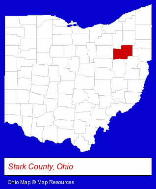
The Ohio counties map at upper right shows Stark County, highlighted in red. Use the menu below to display interactive maps of Massillon, either in a frame on this page or in full-screen mode.
Use the menu below to display categorized Massillon directories.
| Massillon Products and Services Directory | ||
|---|---|---|
| Cremation Services | Funeral Planning | Home Improvement |
| Moving and Storage | ||
Selected Massillon, Ohio Listings
These randomly selected Massillon listings provide some insight into the city's cultural environment and economic climate.- Travel Agents
- Travel Industry
- Cruises Travel Agents
- Airline Travel Agents
- Travel Agencies Information & Referral Services
- Metals
- Floors & Flooring Contractors
- Crane Rental & Leasing
- Heavy Construction Equipment Rental
- Auto Rental
- Auto Leasing
- Insurance
- Health Insurance
- Insurance Consultants & Advisors
- Health Care Plans
- Hospital & Medical Service Plans
- Industrial Equipment & Supplies Dealers
- Building Materials & Supplies Wholesale & Manufacturers
- Plumbing Contractors
- Mechanical Contractors
- Chambers of Commerce
- Lodging
- Hotels
- Motels
Nearby Ohio Cities and Towns *
- Akron (38) - Akron, Ohio products & services directory.
- Barberton (1) - Barberton, Ohio information and maps.
- Canton (21) - Canton, Ohio solutions directory and maps.
- North Canton (10) - North Canton, Ohio demographics and directory.
- Orrville (1) - Orrville, Ohio information and maps.
* Parenthesized numbers indicate economic activity levels.
Copyright © 2011-2026 RegionalDirectory.us. All rights reserved.