Orrville, Ohio Map and Directory
Regional Directory > States Menu > Ohio
 According to the United States Census Bureau, Orrville is a City that is located in Wayne County, Ohio at 40.84 degrees North and 81.76 degrees West.
The city's time zone is America/New York, and the city's primary telephone area code is 330.
The land area of Orrville is about 5.74 square miles, whereas the water area of the city is about 0.01 square miles.
Wayne County's land area is about 555 square miles, so the city occupies about 1.0 percent of the county's total land area.
According to the United States Census Bureau, Orrville is a City that is located in Wayne County, Ohio at 40.84 degrees North and 81.76 degrees West.
The city's time zone is America/New York, and the city's primary telephone area code is 330.
The land area of Orrville is about 5.74 square miles, whereas the water area of the city is about 0.01 square miles.
Wayne County's land area is about 555 square miles, so the city occupies about 1.0 percent of the county's total land area.
The Census Bureau estimates that Orrville had about 8,419 residents in 2019, which is approximately 1,467 people per square mile of land area.
According to recent American Community Survey data, the median household income in Orrville was about $55,129 per year.
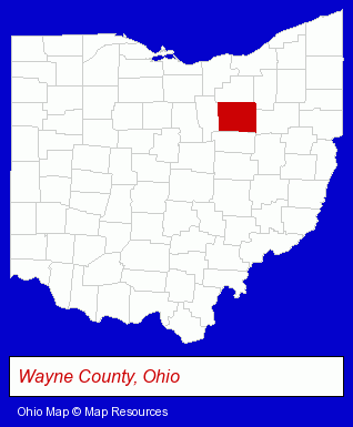
The Ohio counties map at upper right shows Wayne County, highlighted in red. Use the menu below to display interactive maps of Orrville, either in a frame on this page or in full-screen mode.
Use the menu below to display categorized Orrville directories.
| Orrville Directory Page: | Metals |
|---|
Selected Orrville, Ohio Listings
These Orrville listings provide some insight into the city's cultural environment and economic climate.- Accountants
- Accounting, Auditing & Bookkeeping Services
- Tax Return Preparation
- Tax Return Preparation & Electronic Filing
- Payroll & Payroll Tax Preparation Services
- Home Improvement & Maintenance
- Building Materials & Supplies Dealers
- Lawn & Garden Equipment & Supplies Retail
- Concrete & Concrete Products Dealers
- Lawn & Garden Furnishings
- Schools
- Libraries
- Pet Care Services
- Pet Grooming & Boarding
- Pet Grooming
- Metal Products
- Metal Products Wholesale & Manufacturers
- Steel Fabrication
- Insurance
- Health Insurance
Nearby Ohio Cities and Towns *
- Akron (38) - Akron, Ohio products & services directory.
- Barberton (1) - Barberton, Ohio information and maps.
- Canton (21) - Canton, Ohio solutions directory and maps.
- Massillon (4) - Massillon, Ohio information and maps.
- North Canton (10) - North Canton, Ohio demographics and directory.
- Wadsworth (2) - Wadsworth, Ohio information and maps.
- Wooster (8) - Wooster, Ohio demographics and maps.
* Parenthesized numbers indicate economic activity levels.
Copyright © 2011-2026 RegionalDirectory.us. All rights reserved.