Xenia, Ohio Map and Directory
Regional Directory > States Menu > Ohio
 According to the United States Census Bureau, Xenia is a City that is located in Greene County, Ohio at 39.68 degrees North and 83.93 degrees West.
The city's time zone is America/New York, and the city's primary telephone area code is 937.
The land area of Xenia is about 13.01 square miles, whereas the water area of the city is about 0.01 square miles.
Greene County's land area is about 414 square miles, so the city occupies about 3.1 percent of the county's total land area.
According to the United States Census Bureau, Xenia is a City that is located in Greene County, Ohio at 39.68 degrees North and 83.93 degrees West.
The city's time zone is America/New York, and the city's primary telephone area code is 937.
The land area of Xenia is about 13.01 square miles, whereas the water area of the city is about 0.01 square miles.
Greene County's land area is about 414 square miles, so the city occupies about 3.1 percent of the county's total land area.
The Census Bureau estimates that Xenia had about 26,947 residents in 2019, which is approximately 2,071 people per square mile of land area.
According to recent American Community Survey data, the median household income in Xenia was about $45,812 per year.
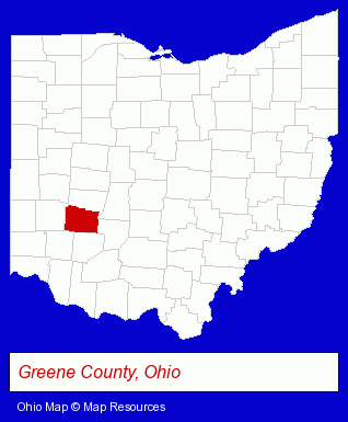
The Ohio counties map at upper right shows Greene County, highlighted in red. Use the menu below to display interactive maps of Xenia, either in a frame on this page or in full-screen mode.
Use the menu below to display categorized Xenia directories.
| Xenia Directory Page: | Moving and Storage |
|---|
Selected Xenia, Ohio Listings
These Xenia listings provide some insight into the city's cultural environment and economic climate.- Dentists
- Orthodontics Dentists
- Financial Services
- Investment Services
- Investment Advisory Services
- Paving Contractors
- Construction Machinery & Equipment Dealers
- Pavement & Parking Area Maintenance & Marking
- Road & Highway Construction Machinery & Equipment
- Printing & Publishing
- Printing Services
- Commercial Printing
- Industrial Equipment & Supplies Dealers
- Auto Parts Wholesale & Manufacturers
- Aircraft Parts & Equipment Wholesale & Manufacturers
- Electric & Electronic Equipment & Supplies
- Consumer Electronics Stores
- Electronic Equipment & Supplies Wholesale & Manufacturers
- Electric Equipment & Supplies Wholesale & Manufacturers
- Building & Home Construction
- Heating Contractors
- Heating & Air Conditioning Contractors
- Air Conditioning Contractors
- Heating Equipment & Systems Dealers
- Skydiving
Nearby Ohio Cities and Towns *
- Dayton (63) - Dayton, Ohio products & services directory.
- Springfield (12) - Springfield, Ohio demographics and directory.
* Parenthesized numbers indicate economic activity levels.
Copyright © 2011-2026 RegionalDirectory.us. All rights reserved.