Enid, Oklahoma Map and Directory
Regional Directory > States Menu > Oklahoma
 According to the United States Census Bureau, Enid is a City that is located in Garfield County, Oklahoma at 36.40 degrees North and 97.88 degrees West.
The city's time zone is America/Chicago, and the city's primary telephone area code is 580.
The land area of Enid is about 73.95 square miles, whereas the water area of the city is about 0.08 square miles.
Garfield County's land area is about 1,058 square miles, so the city occupies about 7.0 percent of the county's total land area.
According to the United States Census Bureau, Enid is a City that is located in Garfield County, Oklahoma at 36.40 degrees North and 97.88 degrees West.
The city's time zone is America/Chicago, and the city's primary telephone area code is 580.
The land area of Enid is about 73.95 square miles, whereas the water area of the city is about 0.08 square miles.
Garfield County's land area is about 1,058 square miles, so the city occupies about 7.0 percent of the county's total land area.
The Census Bureau estimates that Enid had about 49,688 residents in 2019, which is approximately 672 people per square mile of land area.
According to recent American Community Survey data, the median household income in Enid was about $51,952 per year.
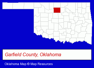
The Oklahoma counties map at upper right shows Garfield County, highlighted in red. Use the menu below to display interactive maps of Enid, either in a frame on this page or in full-screen mode.
Use the menu below to display categorized Enid directories.
| Enid Products and Services Directory | ||
|---|---|---|
| Auto Service | Clinics | Financial Services |
| Funeral Planning | Insurance | Physicians |
| Schools | ||
Selected Enid, Oklahoma Listings
These randomly selected Enid listings provide some insight into the city's cultural environment and economic climate.- Alternative Medicine
- Chiropractors
- Alternative Medicine Practitioners
- Building & Home Construction
- Builders & Contractors
- Building Contractors
- Construction Companies
- Bicycle Dealers
- Exercise & Fitness Equipment Dealers
- Bicycle Rental
- Skateboard & Inline Skates Sales & Rental
- Museums
- Electric Companies
- Electric Equipment Service & Repair
- Water Testing Laboratories
- High Schools
- Christian Schools
- Dentists
- Maxillofacial Physicians & Surgeons
- Attorneys
- Hearing Aids & Assistive Devices Retail
- Home Health Care
- Ambulance Services
- Emergency Ambulance Services
- Wheelchair Retailers
- Chemicals Wholesale & Manufacturers
- Packaging & Shipping Services
- Product Packaging, Labeling & Shipping
- Veterinarians
- Animal Hospitals
- Pet Sitting & Day Care
- Auto Tire Shop Equipment & Supplies
- Window Glass Coating & Tinting
- Truck Parts & Equipment Wholesale & Manufacturers
- Truck Caps & Tonneau Covers Retail
- Custom Car Parts & Accessories
- Auctions
- Auctioneers & Auction Houses
Nearby Oklahoma Cities and Towns *
- Edmond (32) - Edmond, Oklahoma solutions directory and maps.
- El Reno (1) - El Reno, Oklahoma information and maps.
- Norman (21) - Norman, Oklahoma solutions directory and maps.
- Oklahoma City (130) - Oklahoma City, Oklahoma products & services directory.
- Ponca City (2) - Ponca City, Oklahoma information and maps.
- Stillwater (13) - Stillwater, Oklahoma demographics and directory.
- Yukon (4) - Yukon, Oklahoma information and maps.
* Parenthesized numbers indicate economic activity levels.
Copyright © 2011-2026 RegionalDirectory.us. All rights reserved.