Brookings, Oregon Map and Directory
Regional Directory > States Menu > Oregon
 According to the United States Census Bureau, Brookings is a City that is located in Curry County, Oregon at 42.05 degrees North and 124.28 degrees West.
The city's time zone is America/Los Angeles, and the city's primary telephone area code is 541.
The land area of Brookings is about 3.86 square miles, whereas the water area of the city is about 0.07 square miles.
Curry County's land area is about 1,627 square miles, so the city occupies about 0.2 percent of the county's total land area.
According to the United States Census Bureau, Brookings is a City that is located in Curry County, Oregon at 42.05 degrees North and 124.28 degrees West.
The city's time zone is America/Los Angeles, and the city's primary telephone area code is 541.
The land area of Brookings is about 3.86 square miles, whereas the water area of the city is about 0.07 square miles.
Curry County's land area is about 1,627 square miles, so the city occupies about 0.2 percent of the county's total land area.
The Census Bureau estimates that Brookings had about 6,480 residents in 2019, which is approximately 1,679 people per square mile of land area.
According to recent American Community Survey data, the median household income in Brookings was about $62,384 per year.
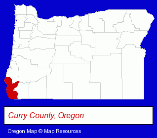
The Oregon counties map at upper right shows Curry County, highlighted in red. Use the menu below to display interactive maps of Brookings, either in a frame on this page or in full-screen mode.
Use the menu below to display categorized Brookings directories.
| Brookings Directory Page: | Building Materials |
|---|
Selected Brookings, Oregon Listings
These Brookings listings provide some insight into the city's cultural environment and economic climate.- Business Services
- Energy & Environment
- Geologists
- Geological Services
- Libraries
- Printing & Publishing
- Publishers
- Newspaper Publishers
- Newspapers & Magazines
- Financial Services
- Financial Planning Consultants & Services
- Attorneys
- Criminal Law Attorneys
- Family Law Attorneys
- Real Estate Attorneys
- Civil Law Attorneys
- Attorneys
- Public Golf Courses
- Private Golf Courses
- Private Golf Clubs
Nearby Oregon Cities and Towns *
- Ashland (11) - Ashland, Oregon demographics and directory.
- Bandon (3) - Bandon, Oregon information and maps.
- Gold Beach (2) - Gold Beach, Oregon information and maps.
- Grants Pass (21) - Grants Pass, Oregon solutions directory and maps.
- Jacksonville (2) - Jacksonville, Oregon information and maps.
- Medford (32) - Medford, Oregon solutions directory and maps.
- Rogue River (1) - Rogue River, Oregon information and maps.
Large and Mid-size Cities in Nearby States
- Eureka, California (5) - Eureka, CA information and maps.
* Parenthesized numbers indicate economic activity levels.
Copyright © 2011-2026 RegionalDirectory.us. All rights reserved.