Hillsboro, Oregon Map and Directory
Regional Directory > States Menu > Oregon
 According to the United States Census Bureau, Hillsboro is a City that is located in Washington County, Oregon at 45.52 degrees North and 122.99 degrees West.
The city's time zone is America/Los Angeles, and the city's primary telephone area code is 503.
The land area of Hillsboro is about 24.29 square miles, whereas the water area of the city is about 0.01 square miles.
Washington County's land area is about 724 square miles, so the city occupies about 3.4 percent of the county's total land area.
According to the United States Census Bureau, Hillsboro is a City that is located in Washington County, Oregon at 45.52 degrees North and 122.99 degrees West.
The city's time zone is America/Los Angeles, and the city's primary telephone area code is 503.
The land area of Hillsboro is about 24.29 square miles, whereas the water area of the city is about 0.01 square miles.
Washington County's land area is about 724 square miles, so the city occupies about 3.4 percent of the county's total land area.
The Census Bureau estimates that Hillsboro had about 109,128 residents in 2019, which is approximately 4,493 people per square mile of land area.
According to recent American Community Survey data, the median household income in Hillsboro was about $82,275 per year.
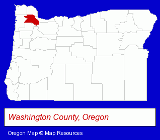
The Oregon counties map at upper right shows Washington County, highlighted in red. Use the menu below to display interactive maps of Hillsboro, either in a frame on this page or in full-screen mode.
Use the menu below to display categorized Hillsboro directories.
| Hillsboro Products and Services Directory | ||
|---|---|---|
| Attorneys | Auto Insurance | Auto Service |
| Building Contractors | Business Services | Chiropractors |
| Coffee and Tea Shops | Dentists | Home Improvement |
| Hotels | Information Technology | Insurance |
| Landscape Contractors | Metals | Moving and Storage |
| Physicians | Schools | |
Selected Hillsboro, Oregon Listings
These randomly selected Hillsboro listings provide some insight into the city's cultural environment and economic climate.- Bicycle Dealers
- Motorcycle, Motor Scooter & Minibike Parts & Accessories
- Printing & Publishing
- Printing Services
- Commercial Printing
- Commercial & Graphic Artists
- Copying & Duplicating Services
- Pet Care Services
- Pet Sitting & Day Care
- Importers
- Exporters
- Computers & Equipment Wholesale & Manufacturers
- Computer Hardware & Supplies
- Computer Peripherals
- Sports & Recreation Facilities
- Health Clubs & Gyms
- Electric Contractors
- Counseling Services
- Marriage & Family Counseling
- Mental Health Counselors
- Child & Adolescent Guidance Counseling
- Adolescent Counselors
- Sports & Recreation Facilities
- Health Clubs & Gyms
- Recreation Centers
- Animal Hospitals
- Caterers
- Take Out
- Box Lunches
- Pet Grooming & Boarding
- Dog & Cat Grooming & Boarding
- Kennels
- Kennel Equipment & Supplies
- Take Out
- Shopping Centers & Malls
- Hotel & Motel Reservations
Nearby Oregon Cities and Towns *
- Beaverton (30) - Beaverton, Oregon solutions directory and maps.
- Forest Grove (3) - Forest Grove, Oregon information and maps.
- Lake Oswego (18) - Lake Oswego, Oregon solutions directory and maps.
- Newberg (2) - Newberg, Oregon information and maps.
- Sherwood (4) - Sherwood, Oregon information and maps.
- Tigard (3) - Tigard, Oregon information and maps.
- Tualatin (7) - Tualatin, Oregon demographics and maps.
Large and Mid-size Cities in Nearby States
- Vancouver, Washington (33) - Vancouver, WA solutions directory and maps.
* Parenthesized numbers indicate economic activity levels.
Copyright © 2011-2026 RegionalDirectory.us. All rights reserved.