Sherwood, Oregon Map and Directory
Regional Directory > States Menu > Oregon
 According to the United States Census Bureau, Sherwood is a City that is located in Washington County, Oregon at 45.36 degrees North and 122.84 degrees West.
The city's time zone is America/Los Angeles, and the city's primary telephone area code is 503.
The land area of Sherwood is about 4.31 square miles, whereas the water area of the city is about 0.00 square miles.
Washington County's land area is about 724 square miles, so the city occupies about 0.6 percent of the county's total land area.
According to the United States Census Bureau, Sherwood is a City that is located in Washington County, Oregon at 45.36 degrees North and 122.84 degrees West.
The city's time zone is America/Los Angeles, and the city's primary telephone area code is 503.
The land area of Sherwood is about 4.31 square miles, whereas the water area of the city is about 0.00 square miles.
Washington County's land area is about 724 square miles, so the city occupies about 0.6 percent of the county's total land area.
The Census Bureau estimates that Sherwood had about 19,879 residents in 2019, which is approximately 4,612 people per square mile of land area.
According to recent American Community Survey data, the median household income in Sherwood was about $103,512 per year.
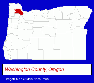
The Oregon counties map at upper right shows Washington County, highlighted in red. Use the menu below to display interactive maps of Sherwood, either in a frame on this page or in full-screen mode.
Use the menu below to display categorized Sherwood directories.
| Sherwood Products and Services Directory | ||
|---|---|---|
| Building Materials | Dentists | Home Improvement |
| Landscape Contractors | ||
Selected Sherwood, Oregon Listings
These randomly selected Sherwood listings provide some insight into the city's cultural environment and economic climate.- Pet Care Services
- Animal Shelters
- Veterinarians
- Emergency Services Veterinarians
- Orthodontics Dentists
- Cosmetic Dentists
- Veterinarians
- Kitchen & Bathroom Remodeling
- Photography
- Professional Photographers
- Landscape Equipment & Supplies Dealers
- Concrete Products Wholesale & Manufacturers
- Sports & Recreation Facilities
- Health Clubs & Gyms
- Recreation Centers
- Ice Skating Rinks & Instruction
- Birthday Parties
- Plumbing Contractors
- Specialty Photographers
- Garden Centers
- Lawn & Garden Sprinklers Installation & Service
Nearby Oregon Cities and Towns *
- Beaverton (30) - Beaverton, Oregon solutions directory and maps.
- Canby (3) - Canby, Oregon information and maps.
- Lake Oswego (18) - Lake Oswego, Oregon solutions directory and maps.
- Newberg (2) - Newberg, Oregon information and maps.
- Tigard (3) - Tigard, Oregon information and maps.
- Tualatin (7) - Tualatin, Oregon demographics and maps.
- Wilsonville (5) - Wilsonville, Oregon demographics and maps.
Large and Mid-size Cities in Nearby States
- Vancouver, Washington (33) - Vancouver, WA solutions directory and maps.
* Parenthesized numbers indicate economic activity levels.
Copyright © 2011-2026 RegionalDirectory.us. All rights reserved.