Wilsonville, Oregon Map and Directory
Regional Directory > States Menu > Oregon
 According to the United States Census Bureau, Wilsonville is a City that is located primarily in Clackamas County, Oregon at 45.31 degrees North and 122.77 degrees West.
The city's time zone is America/Los Angeles, and the city's primary telephone area code is 503.
The land area of Wilsonville is about 7.27 square miles, whereas the water area of the city is about 0.21 square miles.
According to the United States Census Bureau, Wilsonville is a City that is located primarily in Clackamas County, Oregon at 45.31 degrees North and 122.77 degrees West.
The city's time zone is America/Los Angeles, and the city's primary telephone area code is 503.
The land area of Wilsonville is about 7.27 square miles, whereas the water area of the city is about 0.21 square miles.
The Census Bureau estimates that Wilsonville had about 24,918 residents in 2019, which is approximately 3,428 people per square mile of land area.
According to recent American Community Survey data, the median household income in Wilsonville was about $72,312 per year.
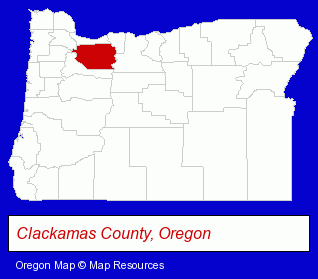
The Oregon counties map at upper right shows Clackamas County, highlighted in red. Use the menu below to display interactive maps of Wilsonville, either in a frame on this page or in full-screen mode.
Use the menu below to display categorized Wilsonville directories.
| Wilsonville Products and Services Directory | ||
|---|---|---|
| Camps | Chiropractors | Dentists |
| Metals | Restaurants | |
Selected Wilsonville, Oregon Listings
These randomly selected Wilsonville listings in 97070 provide a window into the city's cultural environment and economic climate. Abella Italian Kitchen- Italian Restaurants
- Auto Service & Repair
- Auto Body Repair & Painting
- Collision Services
- Auto Paint
- Auto Paintless Dent Repair
- Insurance
- Auto Insurance
- Insurance Agents & Brokers
- Floors & Flooring Wholesale & Manufacturers
- Radio Sales & Service
- Car Audio & Video Retail
- Television Service & Repair
- Web Site Design
- Electronic Commerce
- Insurance
- Bus Travel
- Local Government
- Elderly & Disabled Transportation Services
- Coffee & Tea Shops
- Take Out
- Travel Agents
- Travel Industry
- Veterinarians
- Chemicals Wholesale & Manufacturers
Nearby Oregon Cities and Towns *
- Canby (3) - Canby, Oregon information and maps.
- Lake Oswego (18) - Lake Oswego, Oregon solutions directory and maps.
- Oregon City (10) - Oregon City, Oregon demographics and directory.
- Sherwood (4) - Sherwood, Oregon information and maps.
- Tigard (3) - Tigard, Oregon information and maps.
- Tualatin (7) - Tualatin, Oregon demographics and maps.
- West Linn (3) - West Linn, Oregon information and maps.
Large and Mid-size Cities in Nearby States
- Vancouver, Washington (33) - Vancouver, WA solutions directory and maps.
* Parenthesized numbers indicate economic activity levels.
Copyright © 2011-2026 RegionalDirectory.us. All rights reserved.