Warrington, Pennsylvania Map and Directory
Regional Directory > States Menu > Pennsylvania
 According to the United States Census Bureau, Warrington is a Township that is located in Bucks County, Pennsylvania at 40.25 degrees North and 75.16 degrees West.
The township's time zone is America/New York, and the township's primary telephone area code is 445.
The land area of Warrington is about 13.70 square miles, whereas the water area of the township is about 0.09 square miles.
Bucks County's land area is about 604 square miles, so the township occupies about 2.3 percent of the county's total land area.
According to the United States Census Bureau, Warrington is a Township that is located in Bucks County, Pennsylvania at 40.25 degrees North and 75.16 degrees West.
The township's time zone is America/New York, and the township's primary telephone area code is 445.
The land area of Warrington is about 13.70 square miles, whereas the water area of the township is about 0.09 square miles.
Bucks County's land area is about 604 square miles, so the township occupies about 2.3 percent of the county's total land area.
The Census Bureau estimates that Warrington had about 24,256 residents in 2019, which is approximately 1,771 people per square mile of land area.
According to recent American Community Survey data, the median household income in Warrington was about $106,386 per year.
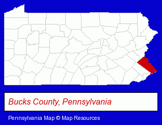
The Pennsylvania counties map at upper right shows Bucks County, highlighted in red. Use the menu below to display interactive maps of Warrington, either in a frame on this page or in full-screen mode.
Use the menu below to display categorized Warrington directories.
| Warrington Directory Page: | Home Improvement |
|---|
Selected Warrington, Pennsylvania Listings
These Warrington listings provide some insight into the township's cultural environment and economic climate.- Musical Instruments Retail
- Musical Instrument Service & Repair
- Pianos & Organs Retail
- Piano Tuning, Repair & Refinishing
- Musical Instrument Parts & Supplies Retail
- Land Surveyors
- Surveyors
- Surveying Services
- Insurance
- Building Materials & Supplies Dealers
- Fence Dealers
- Fence Materials
- Visual Arts
- Photography
- Electronic Equipment & Supplies Wholesale & Manufacturers
- Electronic Equipment & Supplies Retail
- Electronic Components Retail
- Jewelry Repair
- Food Products Wholesale & Manufacturers
- Bagel Shops
- Bagel Wholesalers
Nearby Pennsylvania Cities and Towns *
- Blue Bell (5) - Blue Bell, Pennsylvania demographics and maps.
- Doylestown (11) - Doylestown, Pennsylvania demographics and directory.
- Lansdale (4) - Lansdale, Pennsylvania information and maps.
- Warminster (6) - Warminster, Pennsylvania demographics and maps.
* Parenthesized numbers indicate economic activity levels.
Copyright © 2011-2026 RegionalDirectory.us. All rights reserved.