Sioux Falls, South Dakota Map and Directory
Regional Directory > States Menu > South Dakota
 According to the United States Census Bureau, Sioux Falls is a City that is located primarily in Minnehaha County, South Dakota at 43.54 degrees North and 96.73 degrees West.
The city's time zone is America/Chicago, and the city's primary telephone area code is 605.
The land area of Sioux Falls is about 74.93 square miles, whereas the water area of the city is about 0.52 square miles.
According to the United States Census Bureau, Sioux Falls is a City that is located primarily in Minnehaha County, South Dakota at 43.54 degrees North and 96.73 degrees West.
The city's time zone is America/Chicago, and the city's primary telephone area code is 605.
The land area of Sioux Falls is about 74.93 square miles, whereas the water area of the city is about 0.52 square miles.
The Census Bureau estimates that Sioux Falls had about 183,793 residents in 2019, which is approximately 2,453 people per square mile of land area.
According to recent American Community Survey data, the median household income in Sioux Falls was about $59,912 per year. This Sioux Falls Real Estate directory lists real estate solution providers in Sioux Falls, South Dakota.
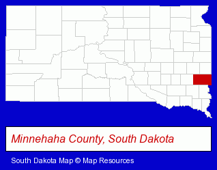
The South Dakota counties map at upper right shows Minnehaha County, highlighted in red. Use the menu below to display interactive maps of Sioux Falls, either in a frame on this page or in full-screen mode.
Use the menu below to display categorized Sioux Falls directories.
Selected Sioux Falls, South Dakota Listings
These randomly selected Sioux Falls listings in 57104 provide a window into the city's cultural environment and economic climate. Benchmark Surveying Inc- Land Surveyors
- Surveying Services
- Household Goods & Furniture Storage
- Rehabilitation Services
- Rehabilitation Centers
- Alcohol & Drug Abuse Information & Treatment
- Addiction Information & Treatment
- Building & Home Construction
- Building Materials & Supplies Dealers
- Builders & Contractors
- Metal Building Contractors
- Roofing Material Dealers
- Fire Departments
- Fireplaces & Accessories Retail
- Fireplaces Wholesale & Manufacturers
- Building & Home Construction
- Electric Contractors
- Building & Home Construction
- Prefabricated & Modular Buildings
- Credit Unions
- Personal Loans
- Business Consultants & Advisors
- Management Consultants
- Business Management Services
- Educational Consultants
- Computer Networks
- Phone Equipment & Systems Dealers
- Phone Equipment & Systems Service & Repair
- Telecommunications Equipment
Nearby South Dakota Cities and Towns *
- Aberdeen (4) - Aberdeen, South Dakota information and maps.
- Freeman (1) - Freeman, South Dakota information and maps.
- Mitchell (2) - Mitchell, South Dakota information and maps.
- Rapid City (17) - Rapid City, South Dakota solutions directory and maps.
- Watertown (2) - Watertown, South Dakota information and maps.
- Yankton (1) - Yankton, South Dakota information and maps.
* Parenthesized numbers indicate economic activity levels.
Copyright © 2011-2026 RegionalDirectory.us. All rights reserved.